Info
District: Safed
Population 1948: 120
Occupation date: 01/05/1948
Occupying unit: Palmah 1st battalion
Jewish settlements on village/town land before 1948: None
Jewish settlements on village/town land after 1948: None
Background:
A1-Wayziyya Before 1948
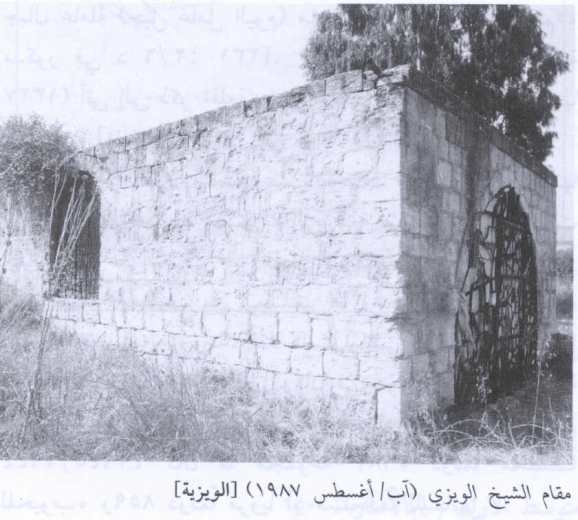
The village was situated in an area underlain by volcanic rocks that sloped toward the al-Hula Plain to the north. A secondaiy road linked al-Wayziyya to a highway leading to Safad and Tiberias. A shrine for a Shaykh al-Wayzi lay about 0.5 km from the site; to the west of the shrine there was a stone Quarry. The bulk of the villagers were Bedouin, who earned their livelihood from animal husbandry, and to a smaller extent from crop cultivation.
Occupation and Depopulation
The capture of al-Wayziyya occurred in April or May 1948, within the scope of Operation Yiftah. Nearby Mughr al-Khayt was hit by mortars on 2 May, while villages to the north were evacuated in late April in anticipation of al-Haganah attack. It probably fell some time before the final assault on Safad on 10 May, as Zionist forces pushed into the city’s hinterland before encircling and occupying it.
Israeli Settlements on Village Lands
There are no Israeli settlements on village lands. Zionists established the settlement of Machanayim in 1939, 1.5 km southeast of the village site.
The Village Today
The shrine of Shaykh al-Wayzi is the only remaining landmark. Rubble from destroyed houses is scattered over the site. Grasses, together with Christ’s-thorn, eucalyptus, and pine trees, grow on the surrounding land, which is used by Israelis primarily as pasture.
---------------------------
Source: al-Khalidi, Walid (ed.). All that remains: the Palestinian villages occupied and depopulated by Israel in 1948. Washington DC: 1992.
Images