Info
District: Baysan
Population 1948: 500
Occupation date: 01/05/1948
Jewish settlements on village/town land before 1948: None
Jewish settlements on village/town land after 1948: None
Background:
Kafra Before 1948
The village was situated in the middle of the Baysan Valley. Its houses were built on both sides of the upper reaches of Wadi Kafra, a shallow valley. A secondary road linked it to the Baysan-Jericho highway, and other roads connected it to surrounding villagers. There was a small forest south of the village. It had been known by the name of Kafra since at least the time of the Crusades, when the Crusaders spelled it “Caffra.” Its population was Muslim. Kafra became a hub of commercial activity for the area, but agriculture remained the mainstay of the village economy. Grain, vegetables, and olives were the main crops. In 1944-45 a total of 7,284 dunums was allocated to cereals; 36 dunums were irrigated or used for orchards. Kafra also was an archaeological in which a through carved out of basalt and the ruins of an ancient village were found.
Israel Settlements on Village Lands
There are no Israeli settlements on village land.
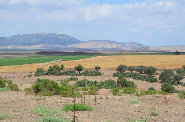
The Village Today
Cactuses grow amid the rubble of the village. Almond, olive and fig trees grow on the site, and a fence surrounds much of the land in the vicinity. Part of the surrounding land is used for grazing but the land near the hill is cultivated, mainly with chick peas. The remains of the basalt through and the ancient village itself are still present but have not been examined by archaeologists.
----------------------
Source: al-Khalidi, Walid (ed.). All that remains: the Palestinian villages occupied and depopulated by Israel in 1948. Washington DC: 1992.
Images