Info
District: Safed
Population 1948: 570
Occupation date: 02/05/1948
Occupying unit: Palmah 1st battalion
Jewish settlements on village/town land before 1948: None
Jewish settlements on village/town land after 1948: A part of Hatzor HaGlilit
Background:
Mughr al-Khayt Before 1948
The village was situated on the northeastern slope of Mount Kan’an in Upper Galilee, overlooking the Ghawr (the low-lying land around the Jordan) between Lakes Tiberias and al-Hula.
The last part of its name, “al-Khayt.” referred to the relatively level plateau which surrounded it and which was known as ard at-khayt. This region was a volcanic sill that separated the basin around Lake Tiberias, to the north, from that of Lake al-Hula, to the south (see Mansurat al-Khayt, Safad District). A secondary road linked Mughr al-Khayt to a highway that led to Safad and Tiberlas. In 1596, Mughr ai-Khayt was a village in the nahiya of Jira liwa’ of Safad) with a population of ninety-four. It paid taxes on a number of crops, including wheat, barley, and fruits, as well as on other types of produce, such as goats and beehives.
In the late nineteenth century, Mughr al-Khayt was a village built of brick and stone. It had a population of about 300 and was known for the many caves in its vicinity. Mughr a]-Khayt was actually a “twin-village,” consisting of two quarters about 100 m apart, spaced parallel to each other in a north-south direction. Its entire population was Muslim. The villagers relied on rainfall to irrigate grain and fruit trees. Their agricultural lands were located on all but the western side of the site. With 540 dunums planted with olive trees in the 1942/43 season, Mughr al-Khayt ranked fifth in olive cultivation among the villages in Safad District. It had two olive presses. In 1944/45 a total of 3,742 dunums was allocated to cereals; 573 dunums were irrigated or used for orchards. An archaeological site near the village (known as al-Maghar) contained the remains of houses, rock-hewn tombs, columns, cisterns, and an olive press.
Occupation and Depopulation
During Operation Yiftach (see Abil al-Qanih, Salad District), Palmach units shelled Mughr al-Khayt with mortars during the night of 2 May 1948. This took place just over a week before the final assault on Safad, and Israeli historian Benny Morris says it may have been designed to increase pressure on the city. But the mortar barrage was mainly initiated “in order that in the end the Arabs would flee from [the village],” in the words of a participating officer. The attack apparently worked, resulting in the evacuation of the village along with two others (Fir’im and Qabba’a) similarly targeted during the same night. It is not clear where the villagers took refuge or what happened to the village itself.
Israeli Settlements on Village Lands
The settlement of Chatzor ha-Gelilit, founded in 1953 on village lands, is 1 km to the southeast of the village site; Ro’sh Pinna , although not on village lands, is only 2 km south of the site; it was founded in 1882.
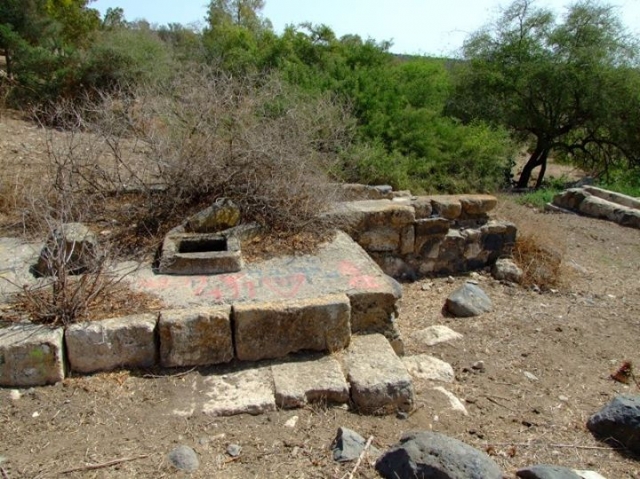
The Village Today
The site is overgrown with grass and cactuses and littered with stone rubble from destroyed houses.
Two cement rooms, built adjacent to one another, still stand and are in relatively good condition. Of the hundreds of olive trees that once grew there, only a few remain. The mountainous land around the site is mostly wooded or used by Israelis as pasture; only a fraction of it is used for growing crops.
------------------------------------
Source: al-Khalidi, Walid (ed.). All that remains: the Palestinian villages occupied and depopulated by Israel in 1948. Washington DC: 1992.
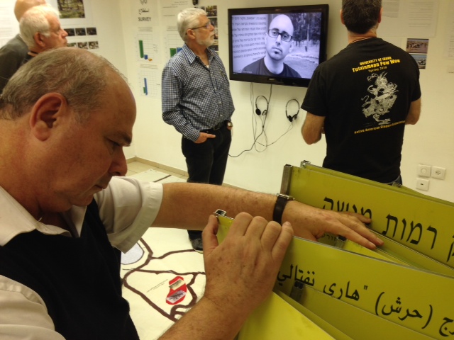
Images
Videos
Booklets
Others
Publications