Info
District: Safed
Population 1948: 80
Occupation date: 17/05/1948
Jewish settlements on village/town land before 1948: Ramot Naftali
Jewish settlements on village/town land after 1948: None
Background:
al-Nabi Yusha’ Before 1948
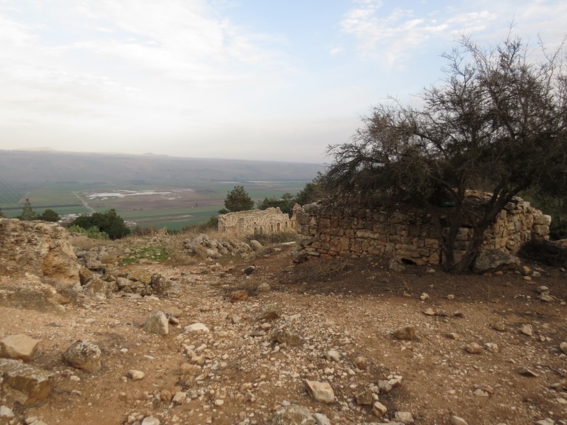
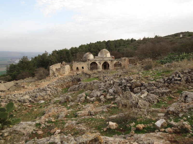
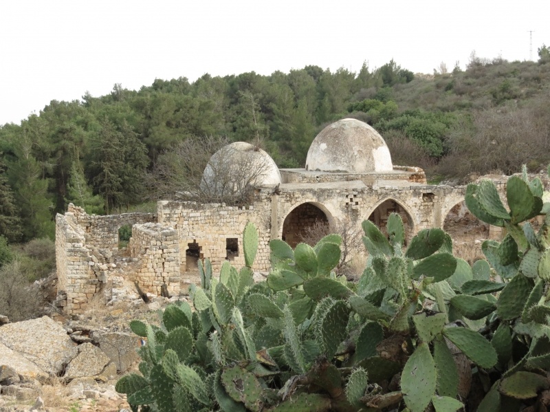
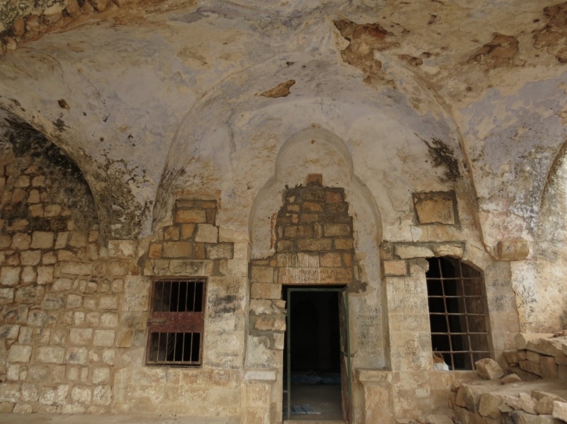
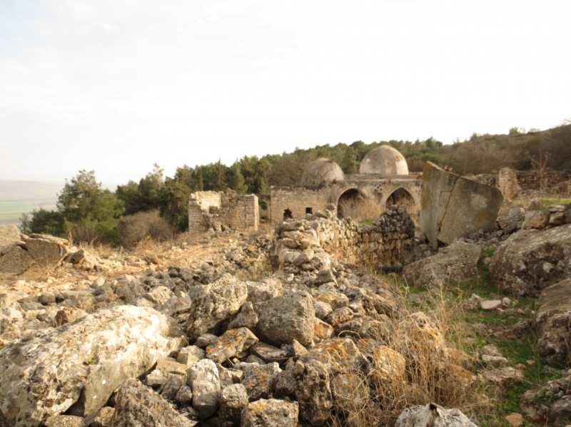
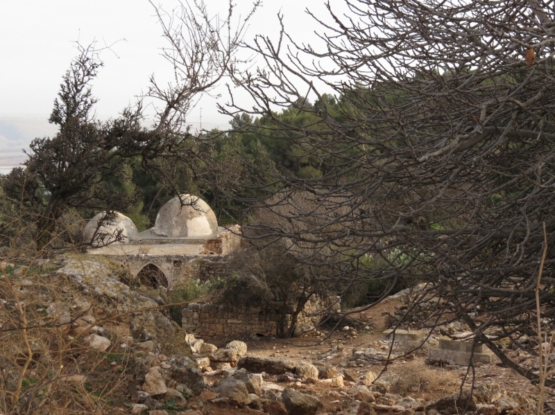
The village was situated near the bed of a small wadi on steepily sloping hills, overlooking the al-Hula Plain to the east and south. The village, linked by a paved spur to a highway that led to Safad and Tiberias, was the site of a shrine that was believed to to be the burial grounds of the prophet (nabi) Yusha’. During the late eighteenth century, a family known as Al al-GhuI established the shrine, which included a mosque and a building for visitors, as an act of devotion. This family, also called the “servants of the shrine,” numbered about fifty and were the first to settle the site; they cultivated the surrounding land, and the place subsequently evolved into a village.
During the Mandate the British chose the village as the location for a police station. The people of al-Nabi Yusha’, all of whom were Muslims, held an annual mawsim, or pilgrimage and festival on the fifteenth of Sha’ban (the eighth month of the Muslim calendar). The ,nawsim was similar to that of al-Nabi Rubin’s festival in al-Ramla District. The villagers earned their livelihood primarily from farming. In 1944/45 they planted a total of 640 dunums in cereals.
Occupation and Depopulation
The village, and its police station in particular, were the targets of four Zionist attacks by the Haganah in April and May 1948. When the British evacuated the al-Nabi Yusha’ police station on 15 April, it was commandeered by units of the Arab Liberation Army (ALA) and other militiamen. According to records kept by ALA commander Fawzi al-Qawuqji, his troops first took up positions around it in late March. The first Haganah attack, which inaugurated Operation Yiftach (see Abil aI-Qamh, Safad District), took place on 17 April. This attack failed. The second raid, mounted three days later, also failed, resulting in the death of twenty-two of the Jewish attackers, according to the History of the Haganah.
The Haganah account relates that the plan was to cut through the barbed wire and mine the police station, but the Palmach unit was discovered at daybreak and shelled by the ALA. Two more attempts were made later during the same operation. An attempt on the night of 15—16 May was quickly called off, but the following night, the attackers received air support, and succeeded in their objective. As the History describes the attack, Israeli planes dropped incendiary bombs on the village police station, while ground units blasted their way through the barbed wire defenses, causing the defenders to withdraw. The fate of the villagers is not explicitly mentioned; they probably fled or were expelled at the time of this attack.
For the next five months (i.e., until the end of the second truce of the war), the front-lines between Israeli and Arab forces ran just outside the village. During Operation Hiram (see ‘Arab al-Sammyya, Acre District), Israeli units coming from the west reached the village in October 1948, thus extending Israeli control over the length of the Lebanese border. A New York Times report stated that fighting on the northern front broke out on 22 October and spread along the entire line from al-Nabi Yusha’ northwards to Manara. Manara , an Israeli settlement with an Arabic name, was founded in the extreme north of Safad District in 1943.
Israeli Settlements on Village Lands
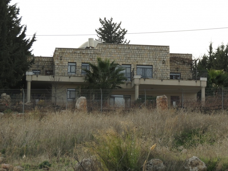
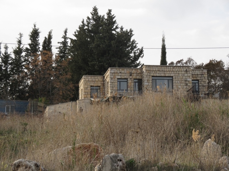
The agricultural settlement of Ramot Naftali , established in 1945 on village lands, is south of the village site. It is close to the border between al-Nabi Yusha’ and the lands of the Arab village of Mallaha.
The Village Today
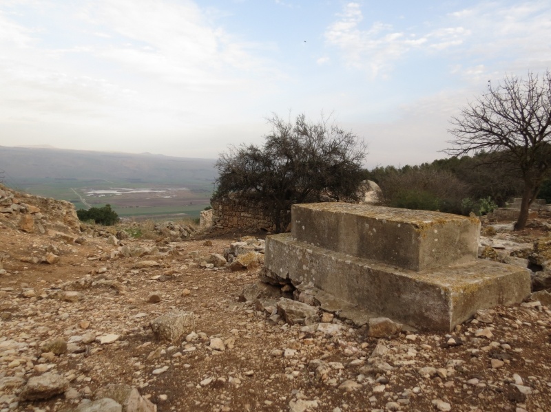
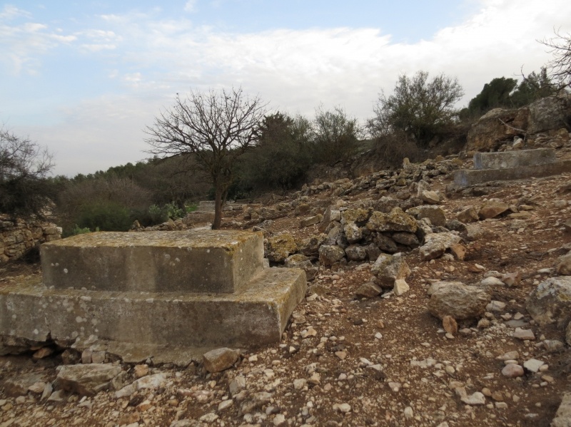
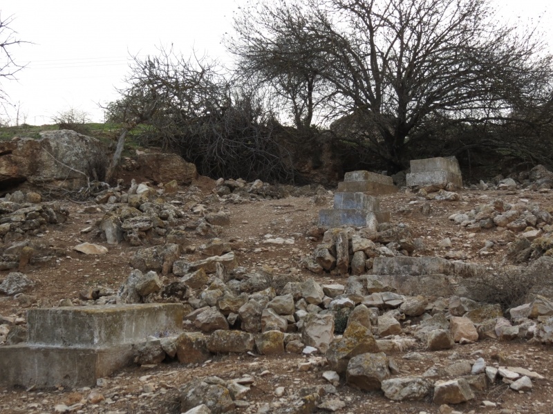
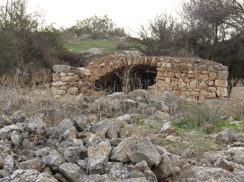
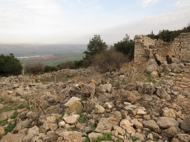
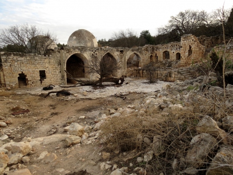
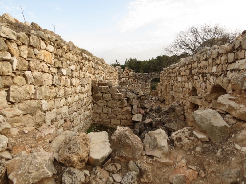
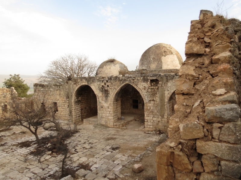
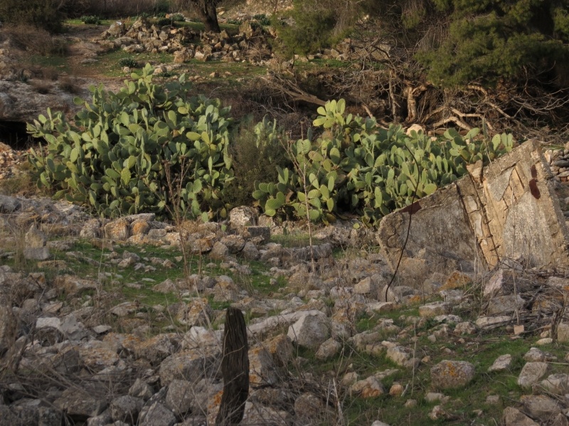
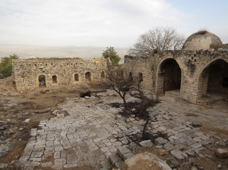
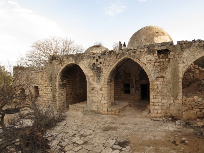
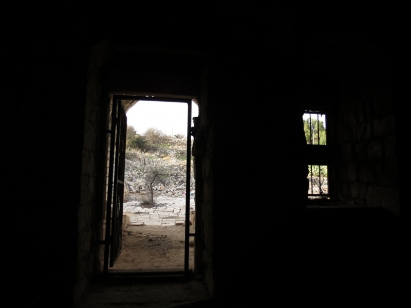
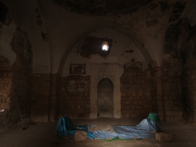
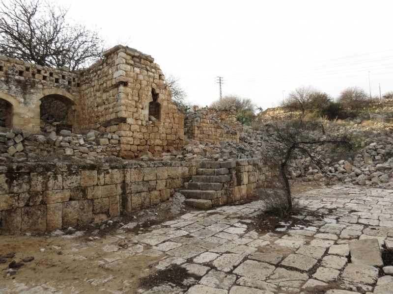
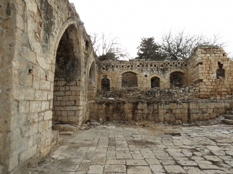
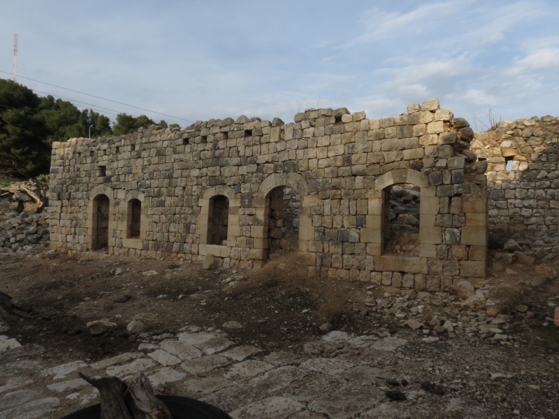
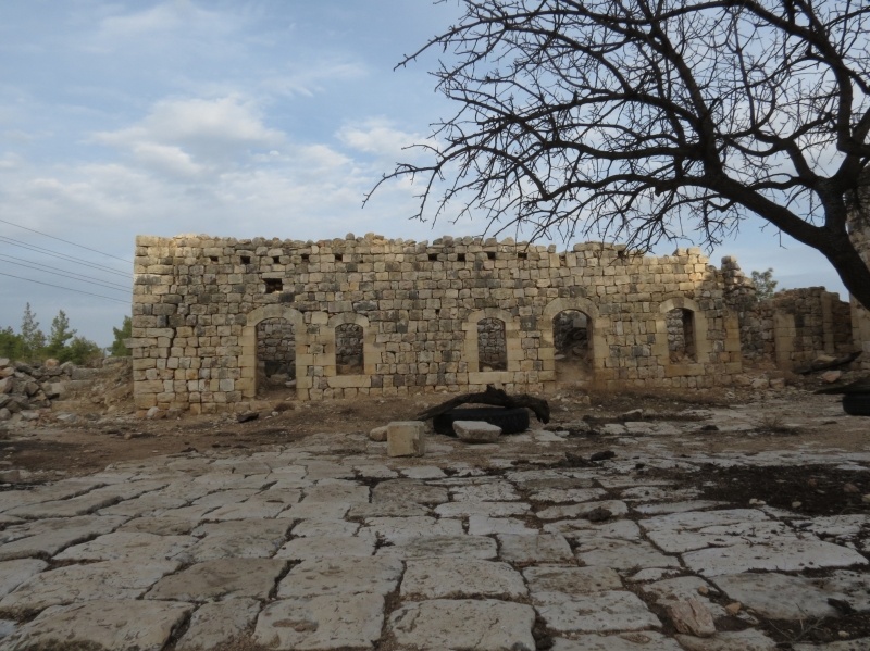
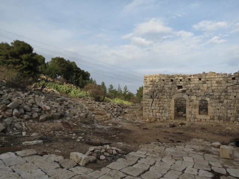
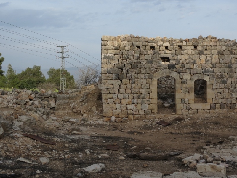
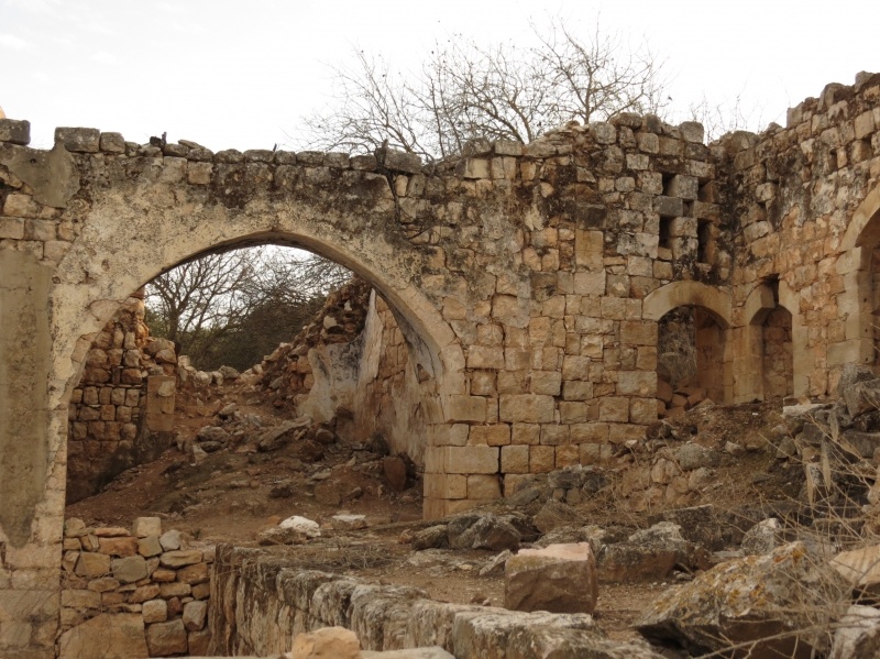
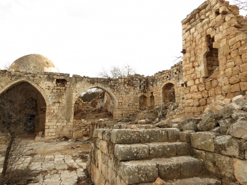
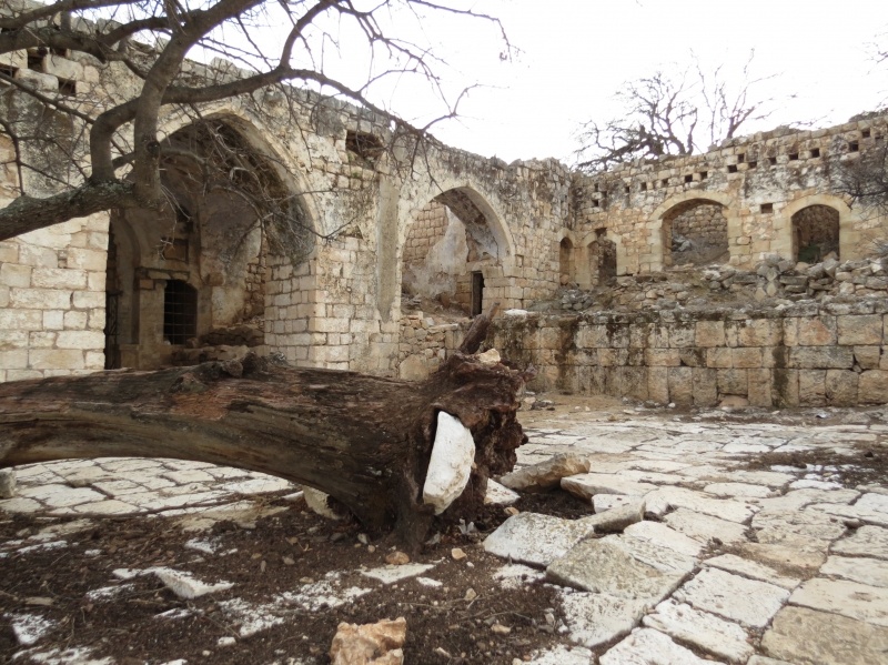
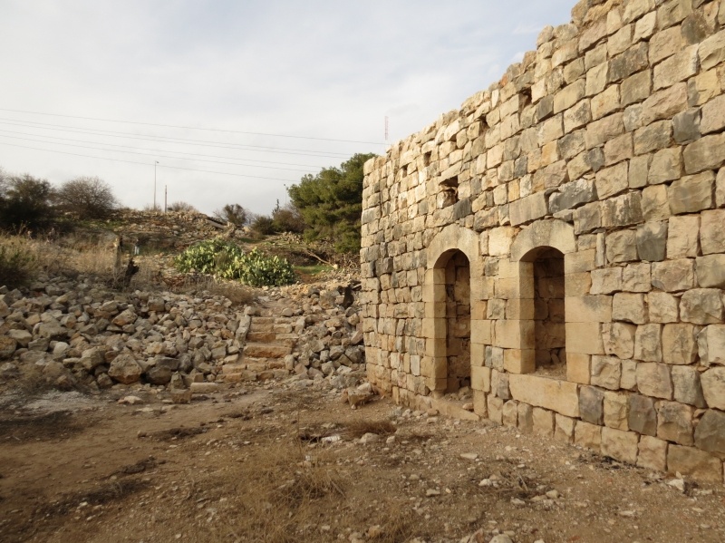
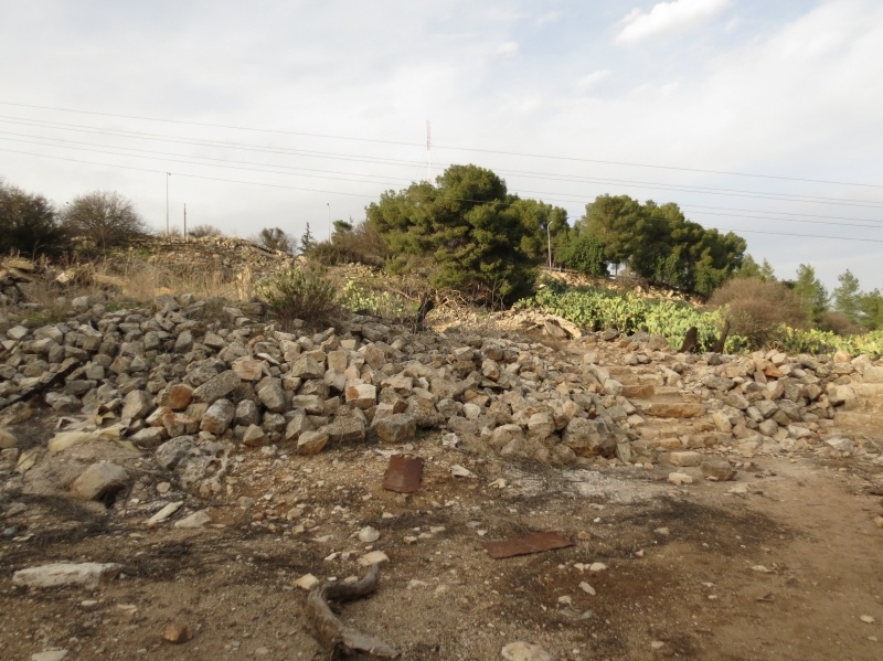
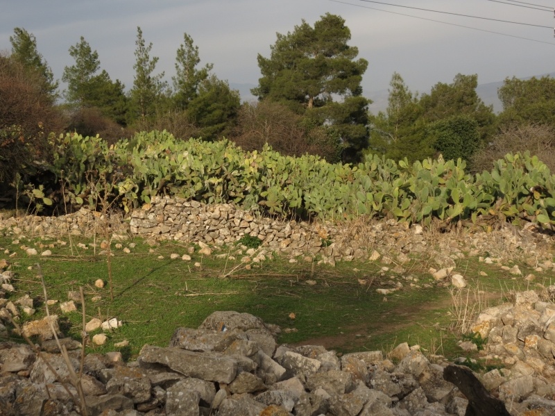
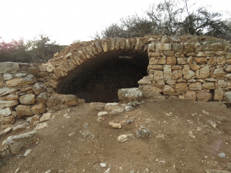
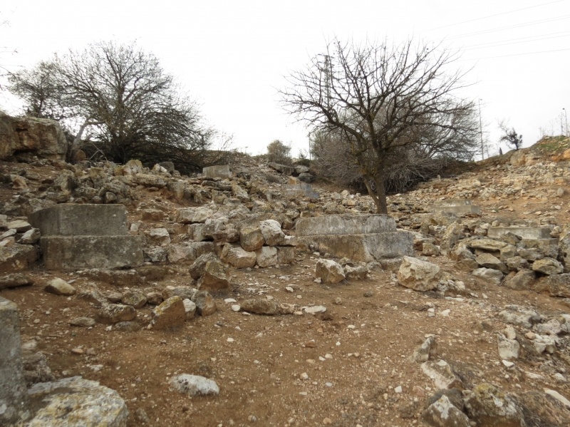
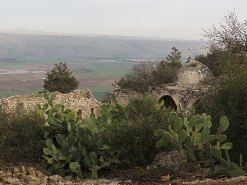
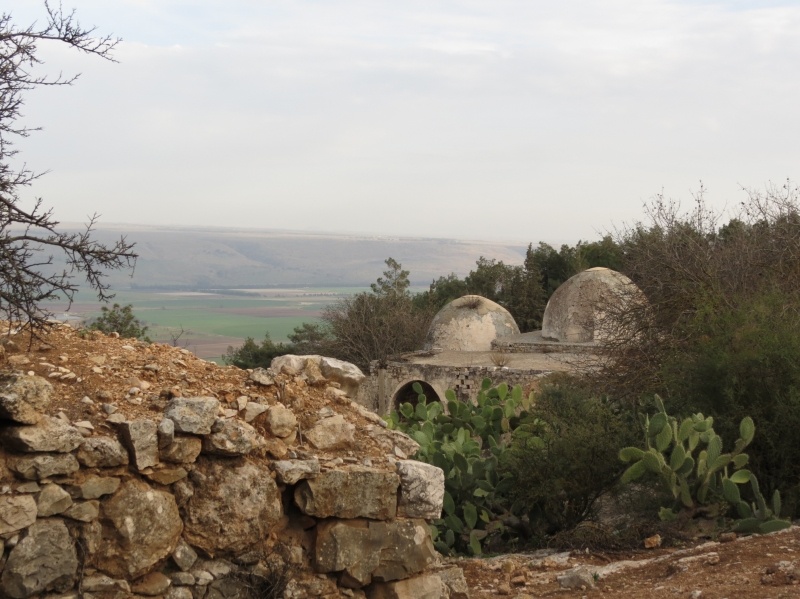
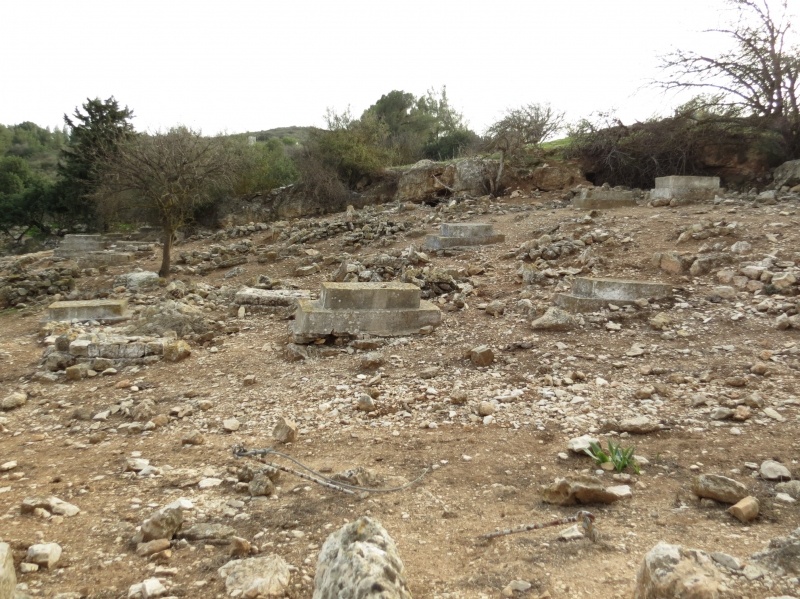
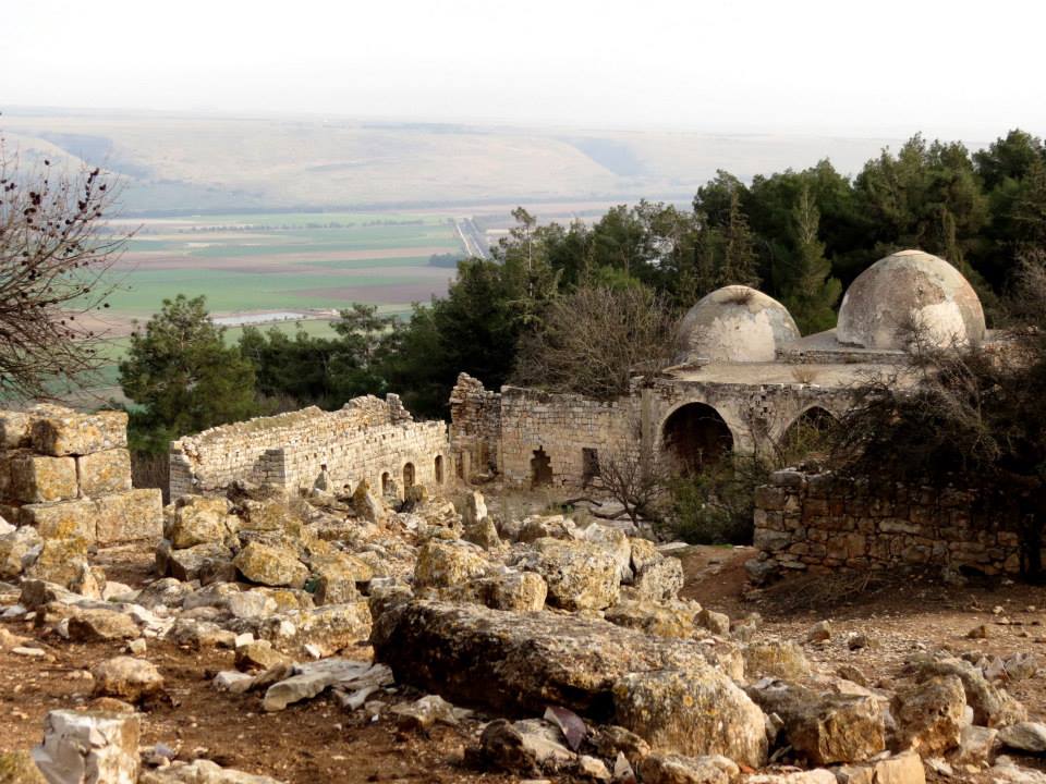
The site has been fenced in with barbed wire and is buried under rubble, making access difficult. However, some evidence of the village remains: fragments of houses, tombs in the village’s cemetery, and the shrine of al-Nabi Yusha’. The two domes and arched entrance of the main part of the shrine are still intact, but the thick stone walls of the rooms attached to it are broken and the entire complex of building is neglected; weeds sprout from the roof. The village site is surrounded by fig trees and cactuses.
The flat lands around the site are planted by Israeli farmers with apple trees, while the sloping parts are wooded or used as pasture.
-------------------------------------
Source: al-Khalidi, Walid (ed.). All that remains: the Palestinian villages occupied and depopulated by Israel in 1948. Washington DC: 1992.
Images


Videos
Booklets
Others
Publications