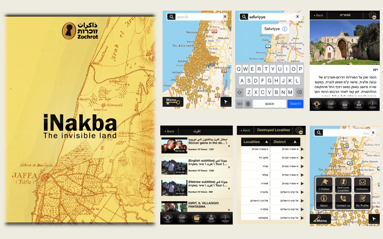
A new mobile app to help locate Palestinian villages destroyed since 1948 is launching Monday night to coincide with Israel's Independence Day, NGO Zochrot has announced.
Residents of over 400 Arab villages were uprooted by the war, referred to by Palestinians as the Nakba, or catastrophe. The villages were either destroyed or repopulated with Jewish residents after the war.
"iNakba is a trilingual mobile app (Arabic, Hebrew and English) based on Google Maps," the NGO, which is dedicated to spreading awareness about he Nakba, stated. "The application provides coordinates and maps of Palestinian localities that were completely demolished and obliterated after their capture, partially demolished, or remained standing although their residents were expelled."
Raneen Jeries of Zochrot told Haaretz Monday that her organization, which has held Independence Day activities for several years, has been working on the idea for about two years, developing it with the help of a company from Nazareth.
"Many people say they are attending tonight," she said. "It's not surprising because the idea of the app and iNakba is more interesting."
Jeries said that hundreds of people have begun downloading the interactive app, which allows users to add pictures and share comments, since it became available on the Apple store Monday morning.
"People have started uploading photos of destroyed villages," she said. "They took their smart phones and went on a tour to look for ruins and to visit the places. We got much positive feedback." She added that two people have already notified her of villages not found on the app.
She noted that there are several meanings of the letter 'i' in iNakba, not just for being associated with Apple. "It's also 'I' as in information or 'I' as in I or me," she said.
Monday evening's event will also include meetings with several academics, including Oren Yiftachel of Ben Gurion University and Yusuf Jabarin of Haifa University. Salman Abu Sitta, a Be'er Sheva-born researcher specializing in documenting the geography of the Nakba, will give a lecture via Skype.
Referring to Abu Sitta's "Atlas of Palestine," Jeries added, "We took the coordinates from these maps and translated them to high tech issues. So we think that maps are a political tool."