There are few countries in the world in which surveying and mapping played so much important role in its history. Palestine, the Holy Land, was long coveted by foreigners, primarily the Crusades and European colonists. They wanted to know its physical and historical characteristics as a prelude to conquering the land.
The first field mapping of the coastal plain using modern surveying methods was prepared by Capt. Jacotin following the trail of Napoleon’s army marching toward Acre in 1799. Jerusalem was mapped by F.W. Sieber (1818), F. Catherwood (1833) and British Royal Engineers (1841). The most detailed map of Jerusalem was prepared by Capt. Charles Wilson (1865) which remained the primary reference till 1937. The Dutch officer C.M.W van de Velde prepared a highly accurate map in his time of greater Syria including Palestine, published 1851, with a detail of Jerusalem. Other specialized maps by the Ottomans, Americans and Jewish settlers were prepared for special purposes or locations.
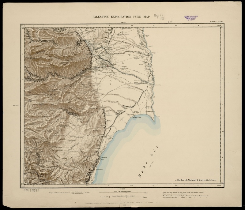
Europe intensified its efforts to rediscover Palestine in the second half of the nineteenth century. Of these efforts, the work of Palestine Exploration Fund (PEF) stands out in its geographical scope and comprehensiveness. The Palestine Exploration Fund (PEF) was founded under the royal patronage of Queen Victoria in 1865 by a group of distinguished academics and clergymen, most notably the Dean of Westminster Abbey, Arthur Stanley, and Sir George Grove.
Palestine was surveyed from Tyre (Sour) in the north to Wadi Ghazza in the south and plotted in 26 sheets to a scale of 1:63,360. The accompanying ten volumes covered archaeological features, fauna, flora, Jerusalem and 10,000 Arabic place names with English transliteration.
The declared purpose of PEF survey was “investigating the Archaeology, Geography, Geology and Natural History of Palestine”.However the ‘underlying wish’ of the founding subscribers to PEF was to find the location of Solomon Temple, the date of the construction of the Dome of the Rock and the original site of the Church of the Holy Sepulchre.
Apart from the Biblical research, PEF survey collected valuable data on Palestinian villages, wells, religious sites, roads and terrain eventually which served the purposes of the British occupation of Palestine in 1917-1918. To prepare for this campaign, known as the Egyptian Expeditionary Force (EEF), more mapping was needed. The veteran surveyor, Capt. S. F. Newcombe surveyed the southern country (Naqab) from Gaza to Aqaba in 1914.
For military purposes this was not enough. To identify Turkish fortifications and town plans, aerial survey was undertaken for the first time. Aerial photos were taken and developed into maps as fast as the army had advanced or sometimes the opposite. A notable example for the use of these photos is Gaza. The artillery map of Gaza was prepared almost entirely on the basis of aerial photos with little field data. While earlier maps were prepared for historical or military purposes, surveying of Palestine after Balfour Declaration of November 2, 1917 was primarily intended to capture the country’s land assets by the Zionists.
__________
Source: The Atlas of Palestine 1917-1966 \ By Dr. Salman Abu Sitta
Download File