In this unit we’ll look at photographs of various places in Israel where remains of Palestinian localities which existed before 1948 are found. We’ll use the photographs to look at familiar surroundings with fresh eyes, in order to recognize traces of the Nakba in the landscape.
Keywords: Place, Education, Art
Goals
To look once more at familiar surroundings in order to uncover remains of the Nakba.
To hear stories we haven’t heard before about places we know.
To develop a critical vision that recognizes not only the remains of the Nakba, but also signs of its erasure.
Activity
1. Slide show, “Seeing the Nakba around us” (Supplementary Material 1): The teacher will show the slides one by one, and lead a short class discussion on each of them. Here are some questions which could be asked with every slide:
Does anyone recognize the place in the photo?
What do you see there?
What don’t you see there?
What do you know about that place?
Using the pupils’ answers, teacher and pupils can discuss what the photographs tell us about the Nakba. At the end of the discussion, it would be a good idea to provide some information about the location (Use the text accompanying the slide show and suggestions in the section “Educational rationale” and in Supplementary Material 1).
Note to the teacher: If the slide show can’t be shown in class, the photographs can be printed and exhibited in the classroom, or passed around among the pupils during class. You could choose four or five photographs to focus on in class, and refer more briefly to the others. We recommend choosing one photograph from each series (each series presents a different kind of erasure – cf. Educational Rationale), and/or photographs the teacher feels would be more relevant and interesting to the pupils.
2. Class discussion. Here are three possible topics for discussion after the slide show, which expand on issues raised by the photographs. You could choose one of the topics to focus on.
A. The sabra (Slide 15): Read the text by Anton Shamas (Supplementary Material 2) and discuss it. Questions might include:
What are the different ways in which the poem defines the “sabra”?
What does the sabra represent to Israelis?
What does the sabra represent to Palestinians?
What do you think is the poet’s message? To whom is it addressed?
B. Names (Slides 16-20): Read the quote from Moshe Dayan that appeared in the slide show, and the paragraph by S. Yizhar (Supplementary Material 3). The discussion could address these questions:
Why were the Arab names erased or changed?
Why didn’t the new Hebrew names catch on in some places, so that even today Israelis refer to them by the Palestinian name (Jerusalem neighborhoods, for example)?
Is it important today to know what the Palestinian names were? Why?
You can also use texts from “Further reading” in Unit 1.
C. JNF forests (Slide 14): Read the story by A.B. Yehoshua, “Facing the forests”. Here are some possible questions for discussion:
What did you feel as you read the story? What do you think about it?
What do you know about forests in Israel (who planted them, why, etc.)?
Did you learn anything from the story which you didn’t know before?
What happens in the story to the main character’s feelings about the Arab and about the forest? Did he discover something he didn’t know before? Does that change his behavior and how he sees things? How?
A suggestion for further activity:
Each pupil will tell about a place he’s familiar with, which he knows, or believes, used to be a Palestinian locality. You could use the slide show to help find locations or landscapes, and then investigate whether they were once Palestinian localities by using the internet and maps from the period. Pupils could be asked to bring a photograph of the location (a list of research aids can be found in Unit 8, Supplementary Material 1).
Supplementary Material 1: Slide show, The landscape of the Nakba: Seeing the Nakba around us.
The slide show is accompanied by written suggestions about using it in the classroom. They refer to each photograph in two ways: The first refers to the general context of the photograph and the phenomenon about which it provides information (the “series,” as described in the Educational Rationale). The second presents information about the specific place in which the photograph was taken. These notes on each slide appear on the CD presentation beneath the photograph, and they can be viewed by changing the View to “Notes page” on the Power Point tool bar. The notes are also included in the envelope accompanying the unit.
Supplementary Material 2: A reading about the sabra, by Anton Shamas
Supplementary Material 3: Readings on the subject of “Place names”
Theoretical Background
The Nakba events in 1948 include the destruction of most Palestinian localities, turning their residents into refugees and erasing the rich Palestinian life which had existed here. The Nakba was part of the 1948 war (the War of Independence), and is one of the main events that has shaped our lives. But the Nakba has been eliminated from Israel’s physical and political space, so we usually know very little about it. Pictures of the country’s landscape have become an integral part of us, and we identify them as characteristic Israeli images. This landscape (still) includes evidence of the lives of Palestinians who lived here. Starting in 1948, the villages, buildings, and remnants of Palestinian lives began to be erased, and they continue to disappear.
The goal of this unit is to look critically at the contemporary landscape, and at our history. As we search for evidence of the Nakba, we begin to know, and learn about its history. The unit links our familiar, personal view of the country’s places with the story of what happened in those places in 1948.
Pedagogical rationale
The process of learning about the Nakba often confronts us with what we don’t know, and involves exposing, and uncovering information that has been repressed. Our knowledge of places we feel close to is mediated by familiar stories, tales that are part of the collective memory. What happens when the place remains the same, but a new story is added, one that might contradict the earlier one? How do we feel then?
During this activity, we’ll learn about the Nakba by examining what exists: our surroundings, the landscape we know. We’ve chosen to begin with a unit dealing with actual space, believing that encountering familiar locations can be a convenient and accessible way of raising this complex topic, one that allows pupils to deal with it from a familiar starting point.
We’ll learn about the Nakba by “reading photographs”, a method which involves looking at familiar photographs in a manner which allows us to see space in a new and different way. The method doesn’t require any advance knowledge or specialization in art. During the activity we show the pupils photographs of different places where the Nakba is present or hidden; each photograph represents one of the various ways in which the Nakba has been erased from the landscape. Reading each photograph involves a number of stages (Examples of applying these stages to read the photographs appear in Supplementary Material 1):
1. Familiarizing the pupil with the location: The teacher begins by asking, “What do we see here?”, “What don’t we see here?”, and “What do you know about this place?” This stage is important because it encourages the pupils to share their knowledge with the class. Since the pupils probably won’t be able to place each photograph, encourage them to guess. In that way you can help them see that the surroundings are familiar even if they don’t know their exact name and location.
2. The second stage begins by asking questions about what the pupils knew regarding the places. The teacher, together with the pupils, will try to discover what is missing in the picture, what relationships does it portray and what does it tell us about the Nakba.
3. Information about the location: The teacher will describe what existed there before 1948, and what happened during that year (Cf. notes to the teacher in the slide show in Supplementary Material 1).
The unit may lead to questions and interpretations that aren’t present in the familiar account. Reading the photograph not only tells what’s present in the location shown in the photo, but also shows what we haven’t been told, and allows us to ask new questions about the place we see in the photo.
The images chosen for this activity are common representations of the Israeli landscape, such as the sabra cactus, deserted hills strewn with stones or structures associated with one of the country’s ancient historical periods. Close reading of the photographs lets us ask questions critically, questions such as: Whose house was that?, What happened to its inhabitants?, Who planted the sabras?, What was their purpose?, Why is there a deserted hill in the middle of the city?, Why are there so many stones there?
Recognizing in our surroundings the remnants of Palestinian life exposes the practices employed to erase the Palestinian Nakba from the Israeli landscape. These practices of erasure appear again and again in various sites throughout the country. We’ve found that these practices of erasure can be identified and grouped into different “series.” Examining one example of each series can teach us about the series as a whole, about that particular practice of erasure. By practicing “reading photographs” we can develop a new way of looking at our surroundings, one which also includes seeing the Nakba.
The series we have chosen are:
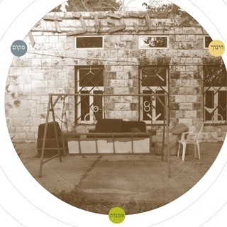
1. Existing Palestinian structures: These buildings remained standing, though not always undamaged. Sometimes they continued to be used for their original purpose (as a school, for example), and sometimes they were adapted for other uses, such as public buildings, residences, religious structures, etc. (Slides 6-10).
2. A village within the city: Some Palestinian villages became integral parts of the Israeli urban landscape. Beginning in 1949, and during the 1950’s, the state of Israel housed Jewish immigrants in some of the Palestinian villages. Over the years many of these residents were moved and the buildings demolished. But there are parts of some villages in which Jews still live today, even though their buildings are in constant danger of being demolished (Slide 11). In a few places, such as Lifta, for example, many buildings are still standing, but only some of them have been reinhabited (Slide 12).
3. Neglect: Palestinian cemeteries were left abandoned and neglected. In many places the gravestones were shattered and scattered everywhere (Slide 13).
4. Concealment: Forests were planted by the JNF and others on the remains and the ruins of Palestinian villages (Slide 14).
5. Sabra cactuses: For us they symbolize the new Jewish generation born in the country, but they are evidence of Palestinian agriculture, which used sabra cactuses as fences. This photograph can serve to initiate a critical discussion of the image of the sabra and the myth constructed around it in Israeli-Zionist culture (Slide 15).
6. Names: The final slide deals with the changing of place names in Israel after the Nakba. Today’s map of Israel is filled with names that were rehabilitated or invented after 1948; we’re not familiar with earlier maps. Our ignorance of Palestinian history is partly due to the erasure of the names and their alteration (Slides 16-20).
By identifying the traces of history in our surroundings, the pupils will experience another stratum of the surroundings with which they’re familiar – but in a new and different way. Moreover, the familiar surroundings show the pupils that they already know something about the Nakba.
Suggestions for further reading
Shai, A. (2002), "The Fate of the Abandoned Arab Villages in Israel, 1965-1969", History & Memory, Volume 18, Number 2, Fall/Winter 2006, pp. 86-106.