Info
District: al-Quds (Jerusalem)
Population 1948: 20
Occupying unit: Har'el (palmah)
Jewish settlements on village/town land before 1948: None
Jewish settlements on village/town land after 1948: None
Background:
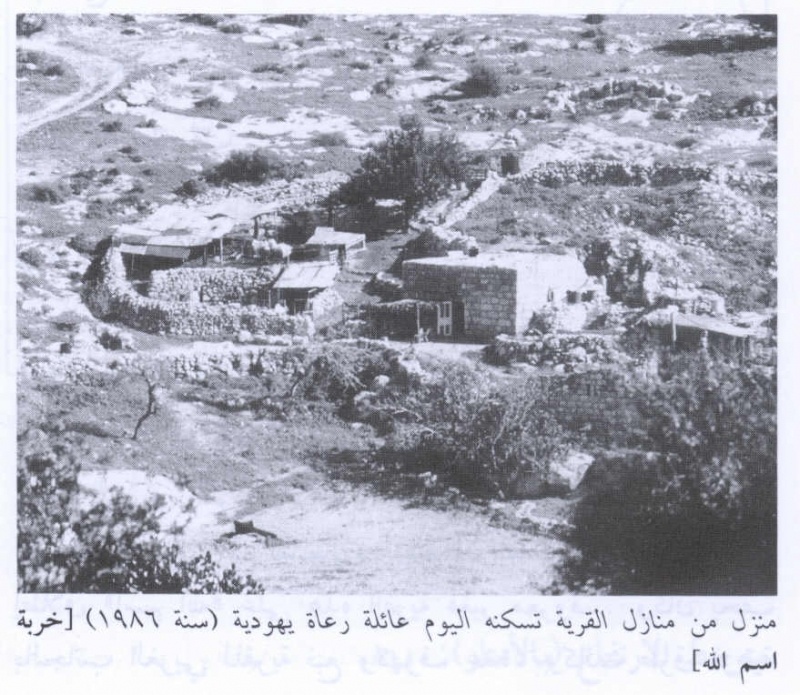
Khirbat Ism Allah Before 1948
The village consisted of two separate clusters of houses that stood on the western slope of a hill; some of the caves nearby, to the north, were also used as dwellings. Ism Allah literally meant „Name of God“ in Arabic; the reason for this designation is not known. There was a spring west of the site as well as numerous caves. Secondary roads and dirt paths linked the village to the highways from Gaza and Bayt Jibrin (a major village in the Hebron district) ant to the al Quds (Jerusalem)-Jaffa highway. Both the village houses and the entrances that had been attached to the cave dwellings were built of stone.
The few families who lived in Khirbat Ism Allah were Muslims. In 1944/45 a total of 485 dunums was allocated to cereals; 3 dunums were irrigated or used for orchards. The village houses stood on the southern edge of a khirba which was an archaeological site; it contained the foundations of walls and a well.
Occupation and Depopulation
Given the village’s location, it may have been captured by the Har’el Brigade on 17-18 July 1948, along with a string of villages on a side road to al Quds. These villages were overrun during Operation Dani, when Israeli forces widened the corridor they had already forged from the coast to al Quds.
Israeli Settlements on Village Lands
In 1944, Zionists established the settlement of Kefar Uriyya about 1.5 km northwest of the village site, close to, but not on, village land.
The Village Today
The caves in the northern part of the site still show evidence of their former use as dwellings; the remains of arched entrances are present. In the southern part of the site, a few ruined houses are surrounded by low stone walls. This area has been recently repopulated by a Jewish shepherd family that renovated and occupied one of the houses. The walled-in area is used as a goat barn, and the entire area has become a grazing site for the family’s flock. The family uses the former village spring, to the west.
-------------------
Source: al-Khalidi, Walid (ed.). All that remains: the Palestinian villages occupied and depopulated by Israel in 1948. Washington DC: 1992.
Images