Info
District: al-Quds (Jerusalem)
Population 1948: 80
Occupation date: 01/07/1948
Occupying unit: Har'el (palmah)
Jewish settlements on village/town land before 1948: None
Jewish settlements on village/town land after 1948: A part of Ramat Raziel
Background:
Bayt Umm al-Mays Before 1948
Bayt Umm al-Mays was situated in a mountainous area facing northwest, and was bordered by two deep wadis to the northeast and southwest which met just northwest of the village. This combination of high elevation and deep wadis on three sides conferred upon the village a degree of strategic importance. A secondary road linked the village to the al-Quds (Jerusalem)-Jaffa highway and to the villages of Suba and al-Qastal. It was known during the Crusader period by the name “Beittelamus.“
The layout of the village was trapezoidal, and its older houses, which were built of stone, were clustered closely together. The newer houses extended to the southeast, towards the mountain that overlooked the village on the south. Bayt Umm al-Mays was classified during the Mandate era as a hamlet by the Palestine Index Gazetteer. Its inhabitants were Muslim.
Potable water was provided by two springs southwest of the village. The agricultural economy was based on the growing of grain and fruit, particularly grapes. Crops were watered by rainfall and irrigated by water drawn from springs. Part of the village land was used as grazing areas for sheep and goats. Most of the agricultural land was south of the village, while vineyards and fruit orchards covered the mountain slopes. In 1944/45 a total of 273 dunums was allotted to cereals; 51 dunums were irrigated or used for orchards. Several khirbas were located near the site.
Occupation and Depopulation
While the circumstances of the occupation of this village are not known, it was almost certainly captured during Operation ha-Har, the thrust into the southern part of the al-Quds corridor after the second truce. Israeli historian Benny Morris indicates that it fell on 21 October 1948, probably to the Har’el Brigade.
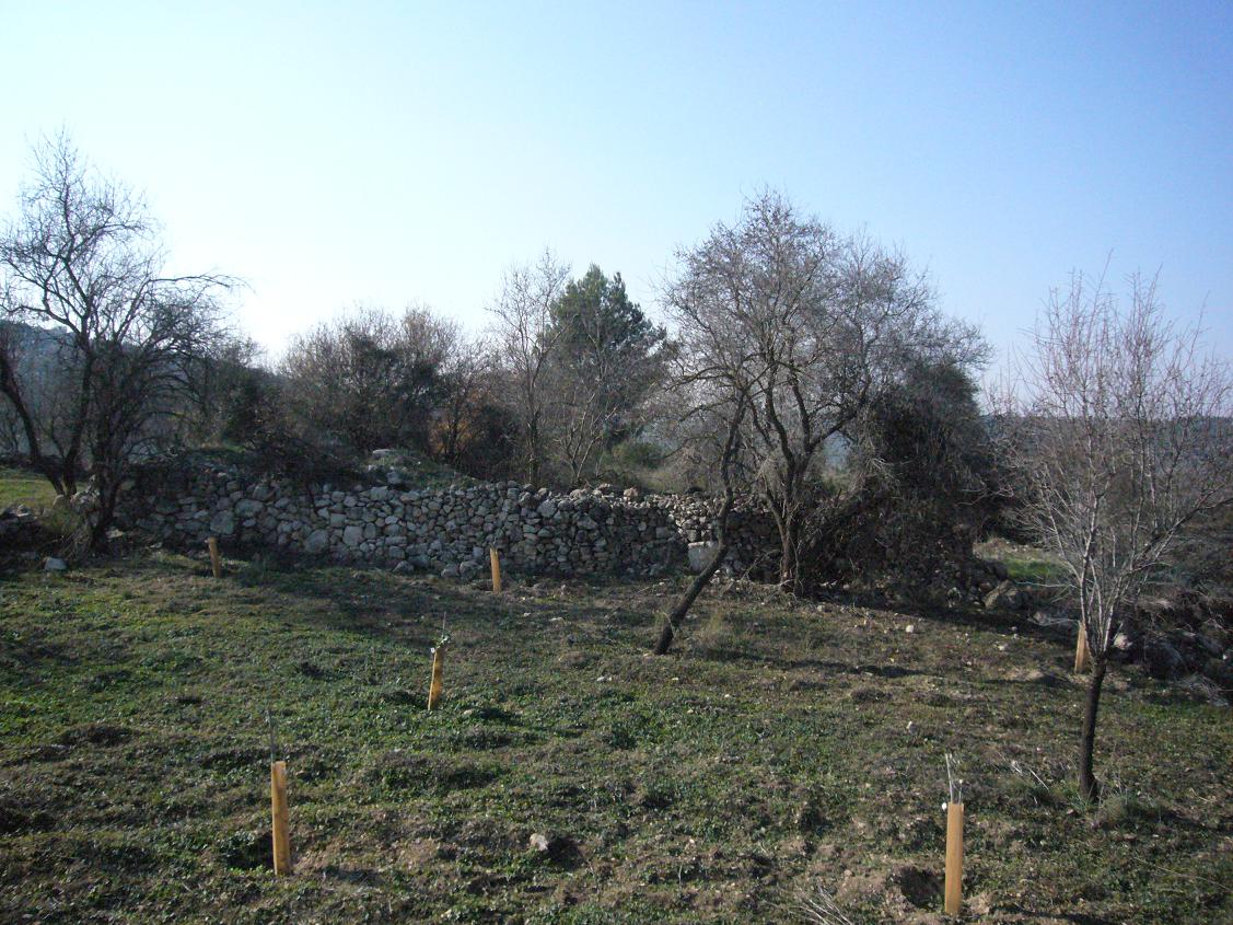
The Village Today
The site is covered with wild grass that grows around the remains of stone terraces. A few almond, olive and fig trees also grow along the terraces. The dried-out stems of vines can be seen among the grass. The remains of a demolished house, which include fragments of an archway, stand at the northern end of the village; the ruins of another house stand at a short distance from the southern end, near a well. Two caves can be seen in the west. There are two very large stone slabs standing at the southern edge of the site, surrounded by bushes.
-------------
Source: al-Khalidi, Walid (ed.). All that remains: the Palestinian villages occupied and depopulated by Israel in 1948. Washington DC: 1992.
Images

Videos
Booklets
Others
Publications