
Info
District: al-Quds (Jerusalem)
Population 1948: 500
Occupation date: 18/07/1948
Occupying unit: Har'el (palmah)
Jewish settlements on village/town land before 1948: None
Jewish settlements on village/town land after 1948: Givat Shemesh
Background:
Dayr Rafat Before 1948
The village was located on the western slope of a moderately high mountain. The first part of its name, Dayr, was Arabic for monastery; the village was the site of a large monastery that belonged to the Latin Patriarchate. The village also had one mosque, named after Hajj Hasan. In the late nineteenth century, Dayr Rafat was a small hamlet situated on a ridge with a spring to the west. Lf the estimated 430 people who were living in Dayr Rafat in 1945, 100 were Christians and the rest Muslims.
In 1944/45 a total of 10,563 dunums was allocated to cereals; 216 dunums were irrigated or used for orchards, of which 25 dunums were used for olives. Water was supplied by three springs on the site. Archaeological sites around the village included three khirbas that contained the foundations of buildings, grape presses, rock-hewn cisterns, wells, a grindstone, and burial grounds.
Occupation and Depopulation
Dayr Rafat was overrun on 17-18 July 1948, during the second stage of the Israeli army’s Operation Dani. The History of the War of Independence relates that it fell to units of the Har’el Brigade towards the end of that operation, when Israeli forces widened the al Quds corridor southwards. Israeli researcher Benny Morris reports that most of the people remaining in the vicinity fled with the approach of the Har’el columns and the start of the mortar barrages. He also adds that the remainder were expelled but it is not clear what transpired at Day Rafat, nor what happened to the residents in the adjacent monastery.
The village was not destroyed until several weeks later, during the second truce of the war. In his comments on the demolition of villages during this period, Morris specifically mentions the case of Dayr Rafat: “During the three months of the Second Truce“ he writes, “From 19 July until mid-October, the army continued to destroy abandoned villages in piecemeal fashion, usually for reasons which were described as military. In the center of the country, for example, most of the village… [was] … blown up in September.“
Israeli Settlements on Village Lands
The settlement of Giv’at Shemesh was established in 1954 on village land, just to the west of the village site.
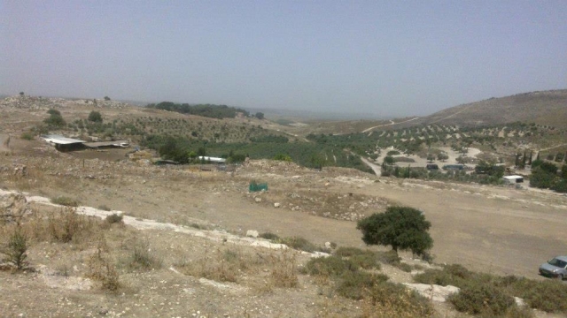
The Village Today
The site is covered with large piles of stone rubble and stone terraces; some of the latter are still intact, while others have been destroyed and are now mixed with the rubble of the houses. Cactuses grow on the northwestern edge of the site. There are a few tents belonging to the Negev tribe of al-Sani’ the members of which have rented land from the monastery, which owns the village lands. The monastery, located 2 km west of the site, has a large statue of the Virgin Mary at the top of its facade, and parts of the structure are covered with red tiles. There is a spring on the western edge of the village and a cemetery lies in the south; one large tomb stands out. To the west there is a large olive grove.
---------------------
Source: al-Khalidi, Walid (ed.). All that remains: the Palestinian villages occupied and depopulated by Israel in 1948. Washington DC: 1992.
Images
Videos
Open discussion and speculation related to return