Info
District: Tiberias
Jewish settlements on village/town land before 1948: None
Jewish settlements on village/town land after 1948: None
Background:
Wadi al-Hamam before 1948
Wadi al-Hamam was a village located 5.5km from the city of Tiberias, located on the northern bank of a wadi (thus also the name of the village). It was located about 3km west of the shore of lake Tiberias with a dirt path linking it to the highway leading to the village of al-Majdal.
Wadi al-Hamam directly translated means “Valley of the Pigeons”. In 1737, the English traveler Richard Pococke visited the village. Almost a century later, the Swiss traveler Burckhardt also visited the village. Both mentioned a fort, known as Qal’at al-Hamam, which lay near the village. According to later sources, bedouins had settled near the wadi.
Occupation and depopulation
There is no information available on the occupation and depopulation of the village.
Israeli Settlements on village lands
There are no Israeli settlements on the village lands.
The village today
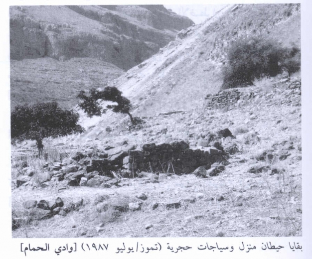
Today, all that is left of the village are the debris of houses and remnants of walls. The village grounds is overgrown with grasses, thorns and some trees.
Near the site, a village with the same name has been set up by Israelis for internal Palestinian refugees. However, these villagers do not own any of the land. Some of the land is used as pasture and some of it is cultivated.
-----------------------------
Source: al-Khalidi, Walid (ed.). All that remains: the Palestinian villages occupied and depopulated by Israel in 1948. Washington DC: 1992.
Images

Videos
Booklets
Others
Publications