
Info
District: Hebron
Population 1948: 1370
Occupation date: 23/10/1948
Occupying unit: Giva'ati
Jewish settlements on village/town land before 1948: None
Jewish settlements on village/town land after 1948: None
Background:
Zakariyya Before 1948
At a distance of 25 km from Hebron, the village of Zakariyya was located on undulating ground underlain by soft white eocene limestone, in the western foothills of the Hebron Mountains. Being next to the road between Bayt Jibrin and the Jerusalem-Jaffa highway, Zakariyya was also linked through side roads to Bethlehem, and a number of villages such as 'Ajjur, Dayr al-Dubban, and Tall al-Safi. The cultural continuity of the area's population with the Roman and Byzantine periods is reflected in its name.
The population of the village was Muslim, and they built their houses of stone and mud on the slope above a broad, flat, valley, surrounded by extensive olive groves. The older parts of the village were located at its centre and in its northern and southern quarters. In addition to a mosque and a shrine, a busy marketplace and an elementary school were also located in the centre. In modern times, the village expanded on all sides, especially to the north and south. Drinking water was provided by two communal wells, as well as several domestic wells that gathered rainwater. As it was usually the case, rainfed agriculture and animal husbandry were the villagers' main economic activities. Many ancient localities were found next to the village site.
Occupation, Depopulation, and Israeli Settlements
The village of Zakariyya came under attack for the first time early in the war, in the course of the battles around the Kfar Etziyon Bloc of Jewish settlements south of Bethlehem. According to some 'Arab sources' quoted in New York Times, Zakariyya was besieged by a Haganah unit estimated at 100 men, along with Dayr Aban and Bayt Nattif. This 'punitive expedition' against the villages was a reaction to an ambush of a Palmach shock force nearby, and persisted for about twenty-four hours. Although the number of casualties was not reported, the Times also stated that Israeli forces fired at the villages on 17 and 18 January 1948.
Zakariyya was taken over nine months later, towards the end of Operations ha-Har and Yo'av. Israeli units broke through the village on 23 October 1948, linking thus the Jerusalem corridor with the Israeli-held parts of the Hebron hills. Although most of the inhabitants of the villages conquered during these operations were not displaced at the time of the occupation, Benny Morris reports that towards the end of 1949 the Israeli military drew up a plan to evict the people of Zakariyya, along with those of some seven other villages. Moreover, even though 'political objections by the Foreign Ministry (and perhaps others) blocked implementation' [Benny Morris], the efforts to expel the people of Zakariyya and the other communities persisted into the following year.
Despite the 'appalling' health and food situation in the village, Morris continues, Zakariyya was one of the longest-lasting of these communities. The Israeli Interior Ministry official in charge of Jerusalem District noted in March 1949 that 'in the village there are many good houses, and it is possible to accommodate in them several hundred new immigrants'. Further on, in January 1950, Ben-Gurion met with his foreign minister, Moshe Sharett, and Jewish National Fund official Yosef Weitz, and decided to evict the inhabitants of Zakariyya. The expulsion took place on 9 June 1950, most of the people being transferred to al-Ramla, with some possibly going to Jordan. During the course of the same year, the settlement of Zekharya was established on village land, close to the village site.
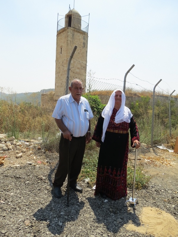
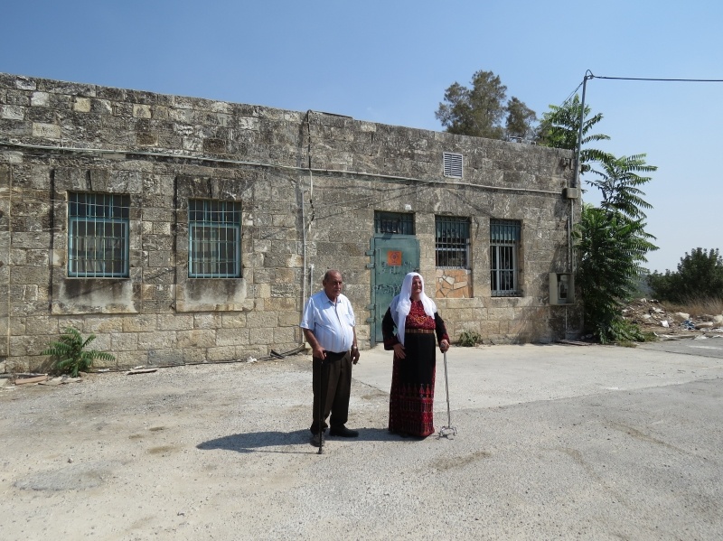
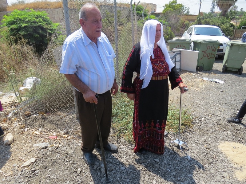
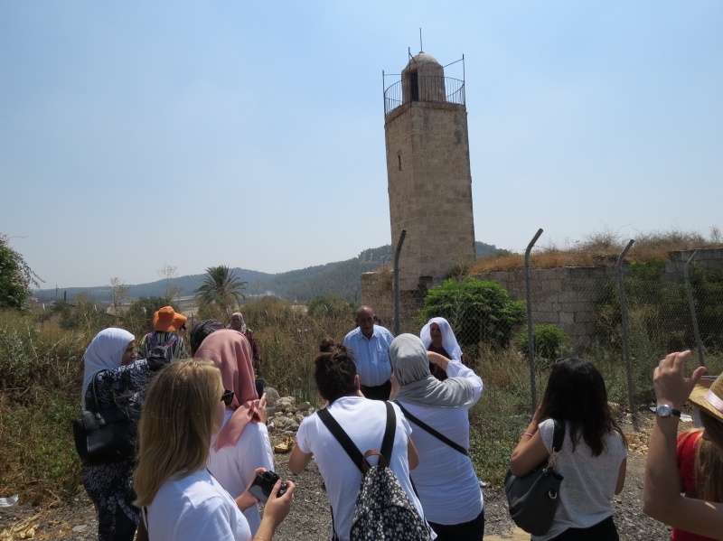
The Village Today
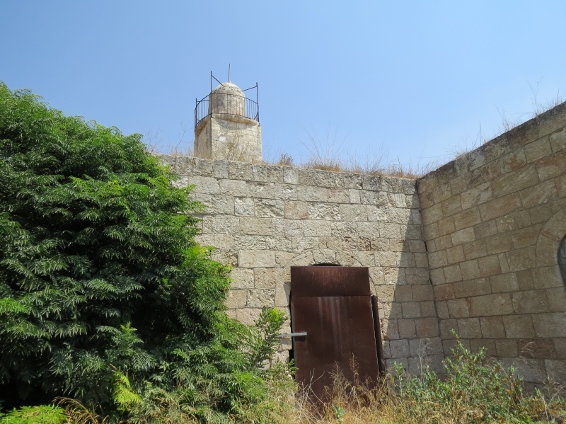
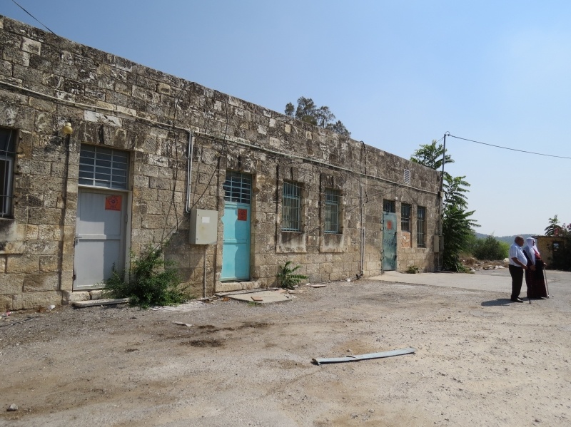
The mosque is now in a state of neglect, with segments of its walls, roof, and the surrounding ground overgrown with wild vegetation. An Israeli flag is planted on top of the minaret. In addition to this, a number of houses also remain on the site, some occupied by Jewish residents and other deserted. Parts of the surrounding lands are cultivated by Israeli farmers.
----------------------------
Source: al-Khalidi, Walid (ed.). All that remains: the Palestinian villages occupied and depopulated by Israel in 1948. Washington DC: 1992.
Images

Videos
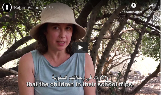
The video, which was screened at Zochrot on the eve of "Independence day, accompanies a group of Israelis who decided to learn about return and its significance, as part of Zochrot's project.
Booklets
Others
Publications

Locality events