Info
District: Tiberias
Population 1948: 570
Occupation date: 02/03/1948
Occupying unit: Hagana units
Jewish settlements on village/town land before 1948: None
Jewish settlements on village/town land after 1948: Poria Hospital
Background:
al-Manara before 1948
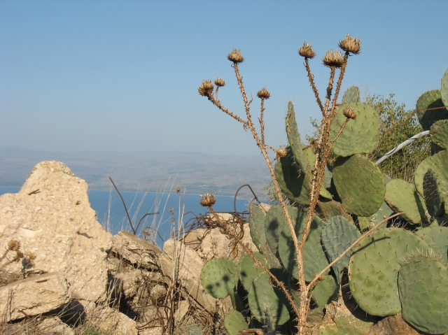
al-Manara was located on a hilltop overlooking lake Tiberias in the lower eastern part of the Galilee. The village had a “twin village” 3 km to the northwest called Nasir al-Din. The village was linked to a highway that led to Tiberias by a secondary road.
al-Manara means “lighthouse” in Arabic. This name may come from the name Kefar Menori, which was located in the same place during the Roman times. By crusaders, it was known as Menan. In 1944-45, the village consisted of 490 Muslim Arabs with 6,797 dunums of land in ownership (the dunums include the twin village Nasir al-Din) The villagers worked in livestock breeding and in agriculture with grain, watermelons and tobacco. The site itself was a small, square area where the houses were crowded closely together. The village was also an archaeological site that contained ruins of houses from previous times. Furthermore, the village was located close to several springs, some of which were hot springs located 1.5km northeast of the lake Tiberias.
Occupation and depopulation
The village fell in March during an attack that preluded the attack on the city of Tiberias. Eyewitnesses stated that the village was attacked by Haganah forces on the 2nd of March, and that they were chased out of their homes by Zionist soldiers. Afterwards, the soldiers destroyed some of the houses, leaving leaflets behind warning the villagers not to return to their homes. This attack demoralized the citizens of the city of Tiberias greatly, as it was the first step in isolating the city by cutting it off from the south. Tiberias was seized the following month.
Israeli Settlements on village lands
The settlement Poriyya was built in 1949 and is located to the south of al-Manara. However, there are no Israeli settlements on the village today.
The village today
The site of the village is levelled with black stone, with palmtrees growing on the northern edge. On the site, a sign reads “This is a historical site, please protect it”, in English, Arab and Hebrew.
-----------------------------
Source: al-Khalidi, Walid (ed.). All that remains: the Palestinian villages occupied and depopulated by Israel in 1948. Washington DC: 1992.
Images