
Info
District: Tiberias
Population 1948: 420
Occupation date: 22/04/1948
Jewish settlements on village/town land before 1948: None
Jewish settlements on village/town land after 1948: None
Background:
al-Majdal before 1948
The village was located on the western shore of the Lake Tiberias, at the foot of a mountain that stood 380m tall. al-Majdal was linked to the city of Tiberias by a highway that wound around the lake shore.
In 1944-45, the village consisted of 360 inhabitants in 62 house. A total of 103 dunums were owned and used at the time. The houses were crowded together, with the exception of a few towards the lake shore. They were built of stone, mud and cement with roofs of wood and cane covered with mud. The village was the smallest in its district in terms of area. The inhabitants were all Muslim and the village economy was based on agriculture with vegetables and grain, with some citrus and banana plantations as well.
al-Majdal was probably the village referred to as Magdala in the New Testament (Luke 7:37 - 50), as the ancient town and home of Mary Magdalene. Furthermore, in Talmudic sources the village was referred to as Migdal Nunaya as a center for fishing and fish-salting. In the Roman period, it was known as Tarischeae, a prosperous Jewish city known for dye making, weaving and the fishing industry. In 1821, the Swiss traveller Burckhardt noted that the village was in poor conditions.
Occupation and depopulation
Little is known of the occupation by Israeli forces. However, the one fact provided is that the villagers left on the 22nd of April, 1948. It is believed that the depopulation was carried out partly through military attack, as well as the demoralizing effect of the fall of the city Tiberias on the 18th of April.
Israeli Settlements on village lands
In 1910, Migdal was established on land purchased by Zionists, located 1.5km northwest of al-Majdal. After 1948 it was expanded to accomodate immigrants and had grown from 213 in 1948 to 830 in 1983, spreading onto village land.
The village today
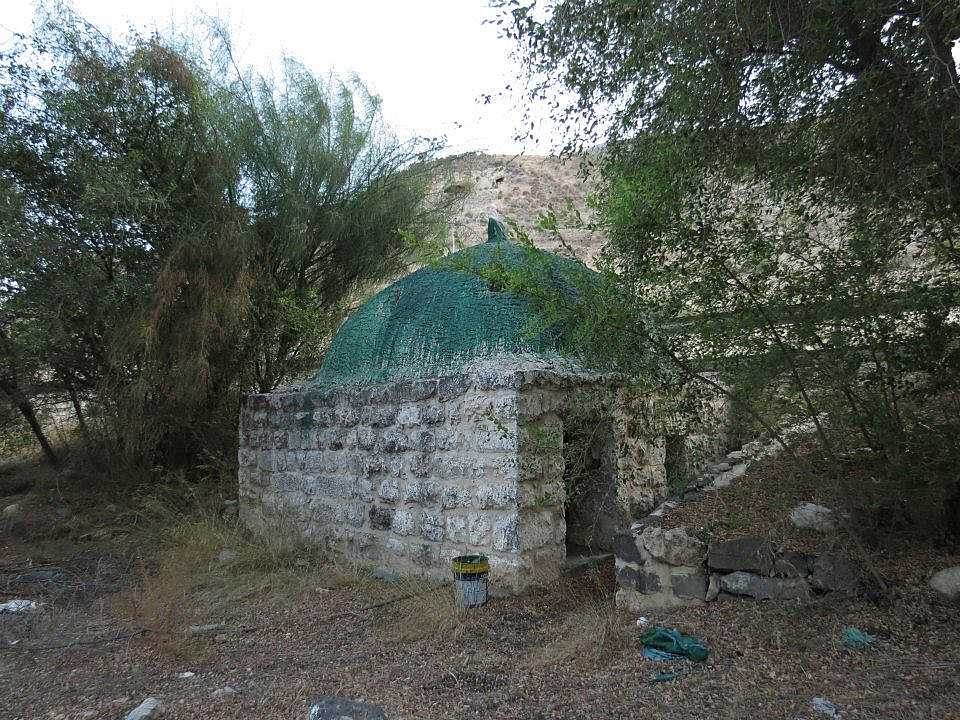
The remains of the village is evident only in the rubble that is left of the houses. On the site, there are Christ’s-thorn and some palm- and olive trees. The only clear remainder of the village is its old shrine of Muhammad al-’Ajami, which is a low, square stone structure with a (fomerly) whitewashed dome. The land in the nearby area is cultivated by Israelis.
------------------------
Source: al-Khalidi, Walid (ed.). All that remains: the Palestinian villages occupied and depopulated by Israel in 1948. Washington DC: 1992.
Images
Videos
Booklets
Others
Locality tours
