Info
District: Safed
Population 1948: 1200
Occupation date: 01/05/1948
Jewish settlements on village/town land before 1948: None
Jewish settlements on village/town land after 1948: Na'ama
Background:
al-Na’ima before 1948
The village was located on flat land in the north west portion of the al-Hula Plain. A secondary road linked it to the village of al-Khalisa and to a highway leading to Safad and Tiberias. Its population was predominantly Muslim. It had a boys’ elementary school. In 1944/45 a total of 156 dunums was allocated to cereals; 4,122 dunums were irrigated or used for orchards.
Occupation and Depopulation
A1-Na’ima was emptied of its population during Operation Yiftach (see Abil al-Qamh, Salad District). One of the main objectives of this operation was to seize control of the city of Safad. The final assault on Safad took place on 10—11 May 1948, and with the fall of the city, the residents of several villages in the district, already demoralized by psychological warfare and mortar shelling, panicked and left. Al-Na’ima was one of these villages; according to an Israeli intelligence report, its residents left on 14 May. It is likely that Israeli troops entered it shortly afterwards, but there is no account of the village’s subsequent fate.
Israeli Settlements on Village Lands
Ne’ot Mordekhay , built in 1946 on village land, is south of the site. North of the village site is the settlement of Beyt Hillel , built in 1940, and to the southeast is Kefar Blum , built some 2 km from the village in 1943.
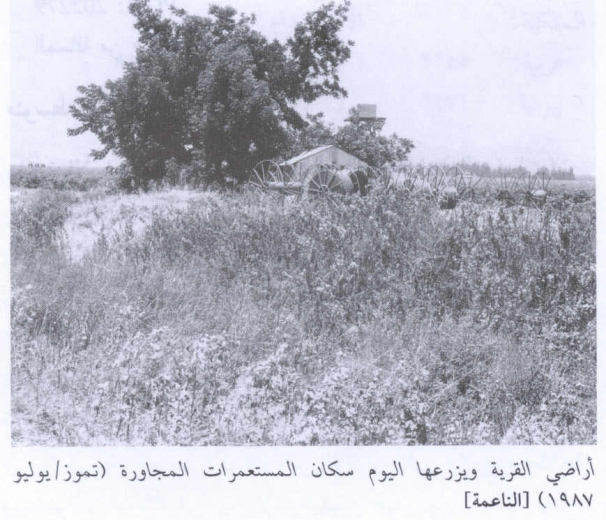
The Village Today
Apart from a few trees, the site is hardly recognizable as the former location of a village. It has become part of the agricultural land of the plain.
----------------------------
Source: al-Khalidi, Walid (ed.). All that remains: the Palestinian villages occupied and depopulated by Israel in 1948. Washington DC: 1992.
Images