
Info
District: Safed
Population 1948: 360
Occupation date: 01/10/1948
Jewish settlements on village/town land before 1948: None
Jewish settlements on village/town land after 1948: Kfar Shamai, Amirim
Background:
al-Sammu’i Before 1948
The village stood on the eastern slope of Mount Zabud, and overlooked Salad to the east. It was about 100 m west of the Salad—Acre highway. In 1596, al-Sainmu’i was a village in the nahiya of Jira (liwa’ of Salad) with a population of 308. It paid taxes on a number of crops, including wheat, barley, and olives, as well as on other types of produce and property, such as goats, beehives, vineyards, and a press which was used for processing either olives or grapes. The American biblical scholar Edward Robinson was told that al-Sammu’i lay on a “comparatively level and easy” road when he passed through the region in the mid-nineteenth century. Guérin, who saw the village in 1852, said that it was populated by 100 Muslims. When the authors of the Survey of Western Palestine reached the village, in 1877, it had 200 residents and was situated on a hill. There was a shrine for a Shaykh Muhammad al-’Ajami in the village as well as a number of cisterns. Many of al-Sammu’i’s stone houses appeared to have been built of ancient materials.
The outline of al-Sammu’i was a narrow rectangle. The‘Arab al-Madariba Bedouin pitched their tents southeast of the village every year when they passed by it in the course of their migratory cycle. Al-Sammu’i had a mosque—its population was predominantly Muslim—and a number of springs. One of them, on the north side, supplied drinking water, which was stored in three water tanks built by the villagers. Fruit and olive orchards were planted on the land south of the village; in the 1942/43 season 170 dunuins were planted with olive trees. In 1944/45 a total of 4,204 dunuins was allotted to cereals and 422 dunums were irrigated or used for orchards. Antiquities inspectors noted that there was a columned building in al-Sammu’i that was in ruins; this and other architectural fragments pointed to an earlier habitation of the site.
Occupation and Depopulation
Israeli historian Benny Morris indicates that al-Sammu’I was wholly or partially evacuated in May 1948, but it was not occupied until October of that year. The initial flight, on 12 May, could have been caused by the fall of the city of Safad on the tenth of that month. This fact, together with the Haganah’s psychological warfare campaign and mortaring of the villages in the area led to the exodus of many communities from the upper Galilee at this time. At the end of October, al-Sammu’i fell within a pocket formed by converging units of the Israeli army during Operation Hiram (see ‘Arab al-Samniyya, Acre District). According to Morris, the village put up some resistance to the Israeli attack. As evidence, he cites the Israeli Minority Affairs Ministry’s reference to al-Sammu’i as an example of a village which resisted and was therefore “depopulated—either by flight or by partial flight plus expulsion.” No further details are given.
Israeli Settlements on Village Lands
Israel established the settlement of Kefar Shammay in 1949 on village lands, just to the east of the village site. Also on village lands, but further to the south, was the settlement of Amirim , founded in 1950.
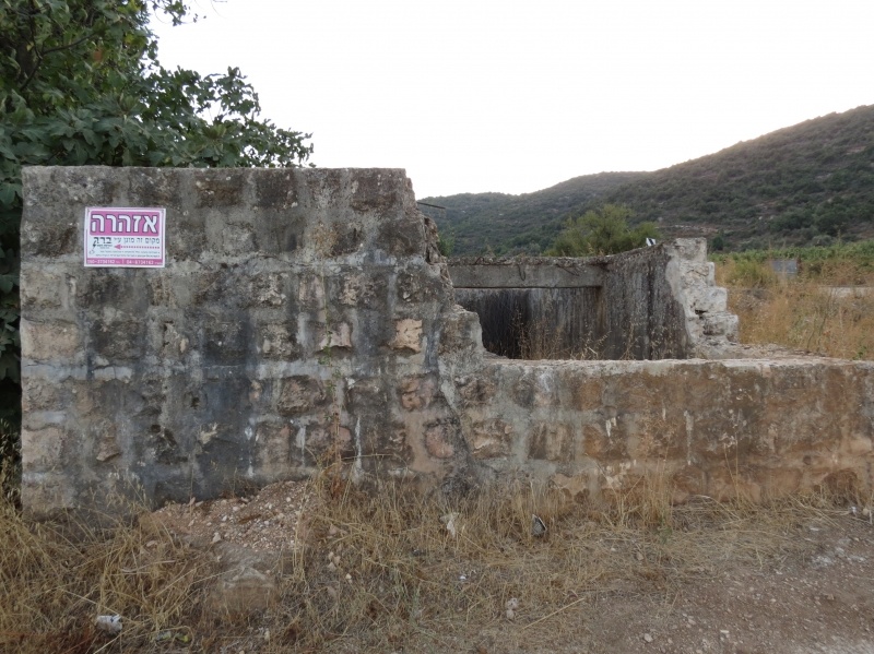
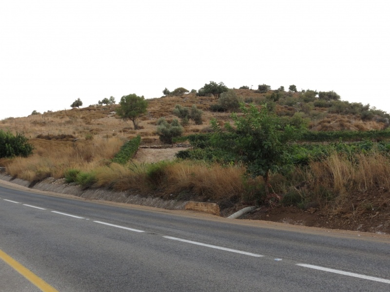
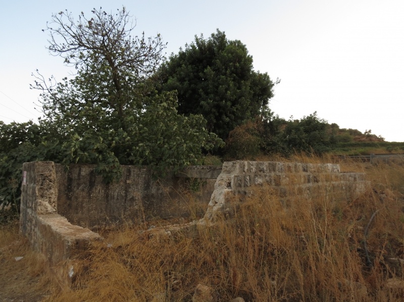
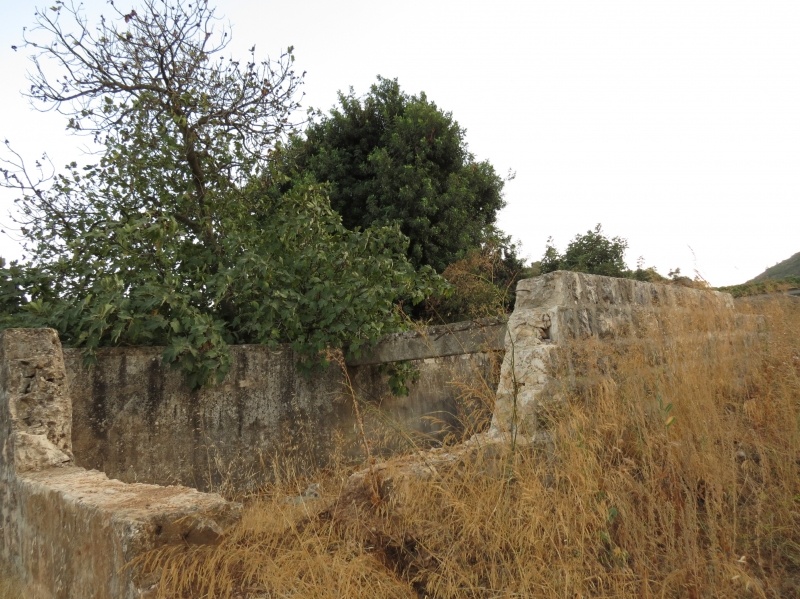
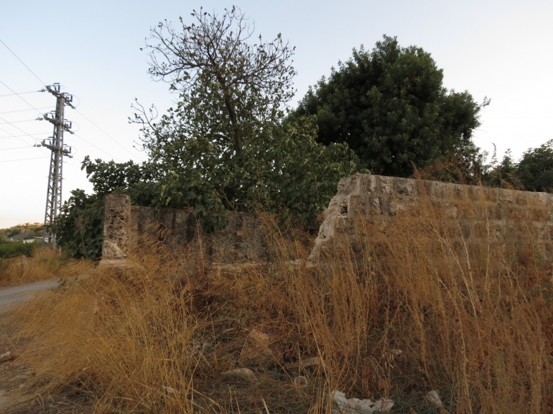
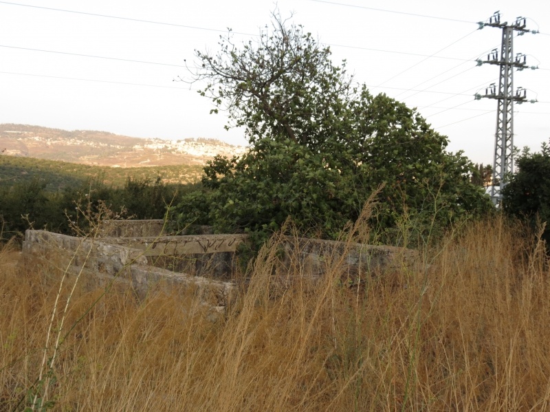
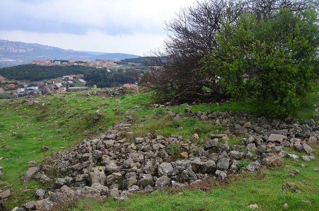
The Village Today
The site is deserted. All that remains of the buildings are some sections of stone walls, a well, and a canal. A few olive and fig trees grow on the site, and the surrounding land is mostly used by Israeli farmers for grazing.
--------------------------------------------
Source: al-Khalidi, Walid (ed.). All that remains: the Palestinian villages occupied and depopulated by Israel in 1948. Washington DC: 1992.
Images
Videos
Booklets
Others
Publications
