Info
District: Haifa
Population 1948: 150
Jewish settlements on village/town land before 1948: None
Jewish settlements on village/town land after 1948: None
Background:
Khirbat Sa'sa' Before 1948
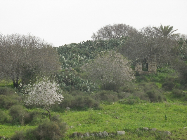
At a distance of 15 km from Haifa, the village was located on a round, slightly elevated mound overlooking the eastern edge of the plain. Since scholars have identified the site as that of Roman Kefar Sasai, it is probable that at least part of the ruins visible in Khirbat Sa'sa' date to the early centuries A.D. Kefar Sasai is known to have been a village near the ancient boundary of Ptolemais (Acre) and Sepphoris (later Saffuriyya, in Nazareth District). Ruins on the site included building foundations, tombs carved in rocks, cisterns, and caves. South of the village lay Khirbat Jabyatha, an artificial mound with exposed wall fragments.
Occupation, Depopulation, and Israeli Settlements
Khirbat Sa'sa' and its nearby villages were part of an area seized in the early weeks of the war. Nevertheless, the majority of the communities in the vicinity were captured during the fall of Haifa, in the last week of April 1948. If the village remained unoccupied until the end of April, it was probably captured at this time by Haganah units who sought to consolidate their hold on Haifa.
There are no Israeli settlements on the village lands, which have been amalgamated with those of the Arab town of Shafa 'Amr.
The Village Today
There are a number of partially collapsed stone walls, one with a large arched opening. Cactuses and fig trees can be found scattered about the site, and the surrounding lands are used as a grazing area.
--------------
Source: al-Khalidi, Walid (ed.). All that remains: the Palestinian villages occupied and depopulated by Israel in 1948. Washington DC: 1992.
Images