
Info
District: Akka (Acre)
Population 1948: 880
Occupation date: 14/05/1948
Occupying unit: Carmeli brigade
Jewish settlements on village/town land before 1948: None
Jewish settlements on village/town land after 1948: Lohamei Hagetaot, Regba expansion, Shavei Zion expansion, A part of Shomrat, A part of Bustan HaGalil
Background:
The village stood on a sandstone hill near the Mediterranean coast. It was located 6 km north of Acre.
The village was occupied on the morning of 14 May 1948, when it was attacked by the Carmeli Brigade from the northwest and the south. This occurred during Operation Ben-Ami. Israeli historian Benny Morris writes that this left “the village's eastern side open to allow the Arabs to escape – which the villagers did as the units mortared the site and closed in.” But Palestinian historian 'Arif al-'Arif states that the village was captured after heavy fighting during which all the young defenders of the village perished when their ammunition ran out. The History of the Haganah relates merely that forces landed by sea at a point nearby and proceeded to take al-Sumayriyya.
Eyewitnesses provided more details which differ somewhat from the versions cited above. The village militia of about thirty-five men was defending the village and was taken by surprise by an armored unit approaching from the south. A villager recalled that one of the men began to fire in the air to welcome what he thought was a unit of the Arab Liberation Army. But he was fire upon and killed instantly. Most of the women and children had been evacuated to Acre and neighboring villages, but the men attempted to repel the attack from the northwest before withdrawing, “leaving behind many killed and injured.” Later, some returned to bury the dead, but could only recover one body in the southernmost part of the village. One of those who returned for a short time reported that “most of the village was destroyed.” That testimony receives corroboration from a photograph in the New York Times less than two weeks after its occupation, showing extensive wreckage in the village caused by “Jewish demolition squads.” The photograph was taken by the Associated Press; according to its caption, the village “was used by Arabs as a sniping point on the north-south highway.”
By June 1948, the Jewish National Fund had initiated the leveling of al-Sumayriyya, with authorization from Israel's prime minister David Ben-Gurion. And some seven months later, on 27 January 1949, a kibbutz (Lochamey ha-Geta'ot, named after the “Fighters of the Ghettoes”) was established on its ruins. Lochamey ha-Geta'ot and Shamrat, founded in 1948, are both on village lands.
Shavey Tziyon and Regba are both close to the northern boundaries of al-Sumayriyya's lands; they were established on land that belonged to the Arab village of al-Mazra'a, which still exists. Shavey Tziyon was founded in 1936 as an armed fortification with a watchtower. A residential quarter called Shekhunat Chof was built nearby and was merged with Shabey Tziyon in 1949. Regba, established in 1946, is close to the village site.
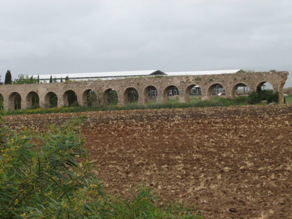
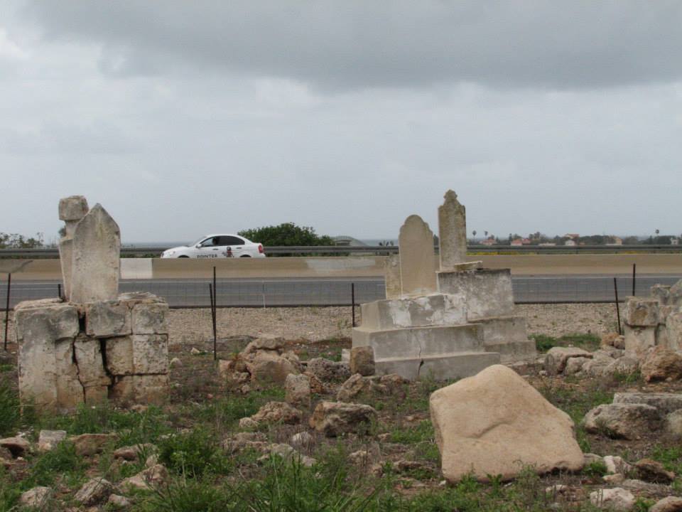
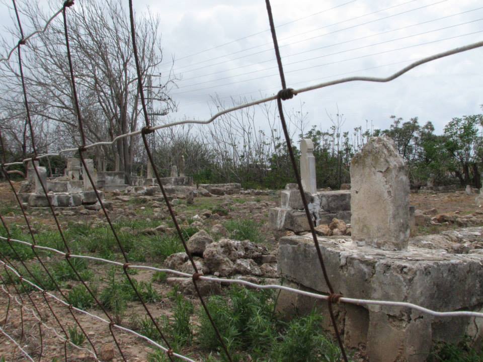
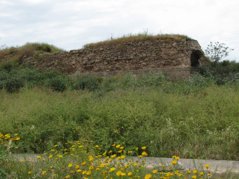
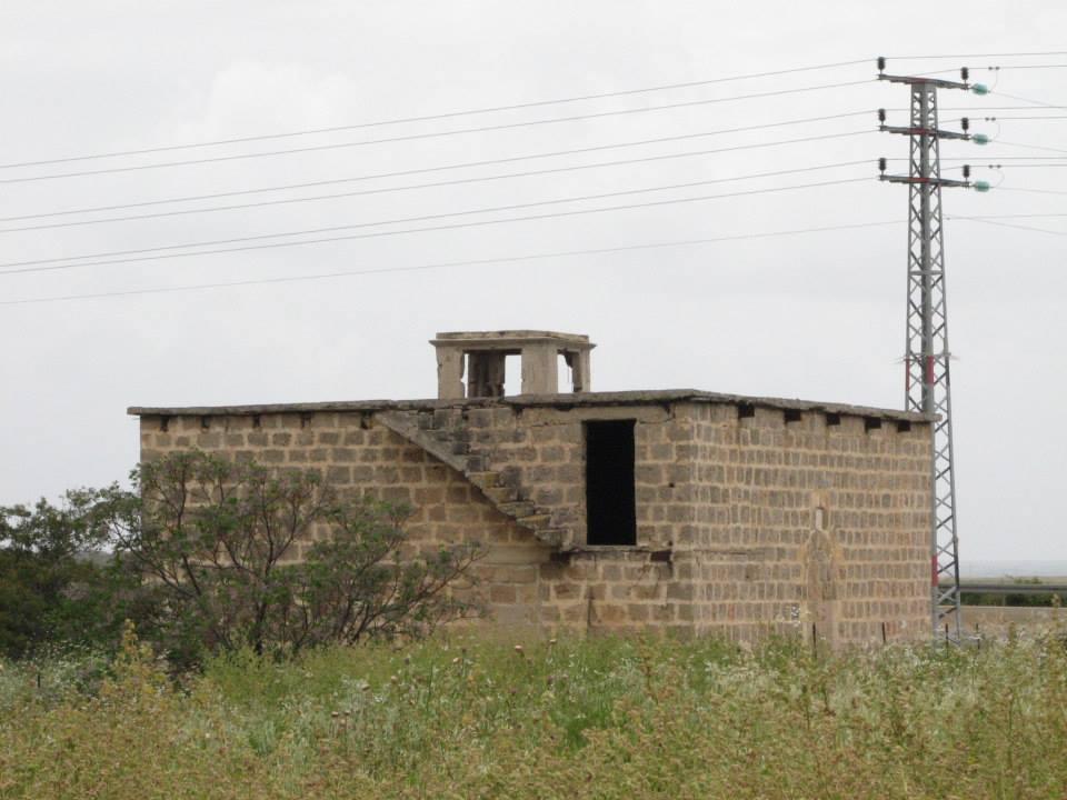
One room from the mosque, portions of a building, segments of walls and arches from fallen houses, and graves are all that remain of al-Sumayriyya. The remaining part of the mosque is a square stone building with a flat roof that is supported on girders and crossbeams. It has a round-arched doorway that is presently closed. Most of the site is covered by a forest of eucalyptus trees interspersed with bushes and wild grass. There is a cowshed on the site's northern section. The lands in the vicinity are cultivated by the settlement of Regba.
Images

Videos
Booklets
Others
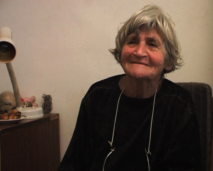
Locality testimonies
Locality tours
