Info
District: Safed
Population 1948: 280
Occupation date: 29/10/1948
Jewish settlements on village/town land before 1948: None
Jewish settlements on village/town land after 1948: None
Background:
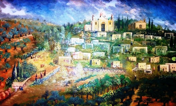
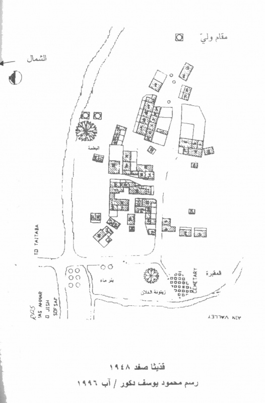
Qaddita Before 1948
The village was situated on the slope of a hill and faced southeast. Its name could have been a corruption of the Syriac word kaddisha, “sacred.” A secondary road linked it to a highway going to Safad. In 1596, Qaddita was a village in the nahiya of Jira (liwa’ of Safad) with a population of 149. It paid taxes on a number of crops, including wheat and barley, as well as on other types of produce and property, such as goats, beehives, and vineyards. In the late nineteenth century, Qaddita was a village built of stone and mud; the slope on which it was located was partially covered by gardens and fig trees. The village’s population, estimated at 200, lived in “ten houses” It seems likely that at least one or two of these “houses” were clusters of one-room dwellings centered around enclosed courtyards; such a house could shelter a number of related families. In modem times Qaddita extended in a northwest-southeast direction, following the contours of the land. Its houses, made of stone, were grouped closely together. Its entire population was Muslim. Its economy was based on animal husbandry and crop cultivation, the most important crops being grain and fruits such as grapes, figs, and pomegranates. In the 1942/43 season 77 dunums of village land were planted with olive trees. In 1944/45 a total of 1,452 dunums was allotted to cereals; 150 dunums were irrigated or used for orchards.
Occupation and Depopulation
Directly after the fall of Safad, a number of eastern Galilee villages were evacuated, and Qaddita was one of them, according to Israeli military intelligence. By 11 May 1948 it had been emptied of its residents, under the influence of the capture of Safad on 9—10 May. Israeli historian Benny Morris does not make clear whether or not Haganah forces mounted a direct attack on the village when they entered it, nor does he say whether they destroyed it. Qaddita was one of the westernmost villages to fall within the scope of Operation Yiftach (see Abil al-Qamh, Salad District), designed in part to render eastern Galilee “Arab-free.” Some villagers were apparently evicted some time after the village was occupied. In 1949, Morris reports that some refugees from Qaddita had been transported to ‘Akbara, just south of Salad. They lived there in harrowing circumstances and these conditions “remained bad for years.”
Israeli Settlements on Village Lands
There are no Israeli settlements on village lands. However, the settlements of Sifsofa, built on Safsaf village lands to the northwest, and Dalton, built on Dallata village ands to the northwest, are not far from the site.
The Village Today
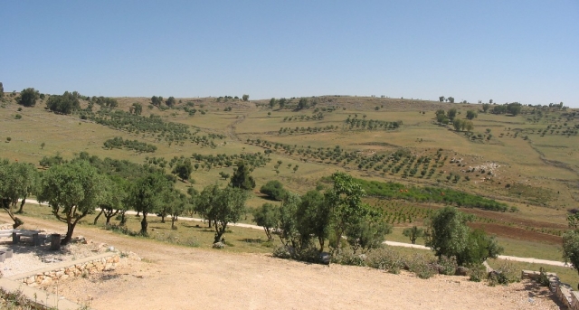
All that remains are tombs from the cemetery and stone rubble from the destroyed homes. The site is covered with thorns and weeds, as well as a few neglected fig and olive trees.
The newly settlements have planted forests as well as fruit trees on some of the surrounding land.
--------------------------------
Source: al-Khalidi, Walid (ed.). All that remains: the Palestinian villages occupied and depopulated by Israel in 1948. Washington DC: 1992.
Images
Videos
Booklets
Others
Publications