Info
District: Jenin
Occupation date: 12/05/1948
Occupying unit: Golani
Jewish settlements on village/town land after 1948: Kibbutz Ma'ale Gilbo'a
Background:
The village was situated 12 kilometers west of Jenin, on the top of a small circular plateau that extended from the northern slope of a mountain (Jabal Faqqu'a). It overlooked the Jordan Valley to the north and northeast, and was linked by a dirt path to the village Tall al-Shawk in District of Baysan.
Although the village was part of Jenin district, it was separated from Jenin by Jabbal Faqqu'a and was more strongly affected by events in the town of Baysan, only 7 kilometers to the west. Thus, it was probably captured by the Haganah's Golani brigade in May 1948, during its push towards Baysan and the surrounding valley. According to Israeli historian Benny Morris, the residents of Khirbat al-Jawfa may have fled on 12 May as a result of the capture of Baysan, which surrendered the same day.
The 1948 armistice line separating Israel from the West Bank fell a short distance to the west of Khirbat al-Jawfa, cutting through the land of the nearby village of Faqqu'a, (on the West Bank). The land of this village that was inside Israel have been combined with the land that belonged to Khirbat al-Jawfa, making the two indistinguishable. The settlement of Ma'ale Gilboa, founded 1962, is located inside this amalgamated parcel of land, southwest of the village site.
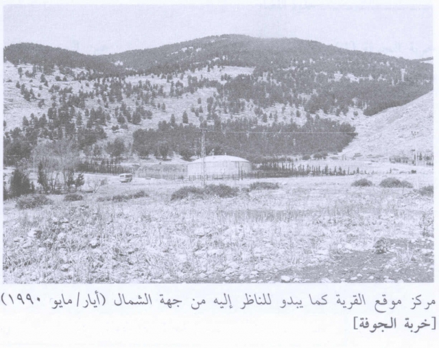
Although sections of some walls still stand, most of the former houses have been reduced to rubble. The entire area has been fenced in and is used as a grazing area for cows. A large water tank belonging to kibbutz Ma'ale Gilbo'a is on the site.
Images