
Info
District: Tiberias
Population 1948: 1380
Occupation date: 17/07/1948
Occupying unit: 7th brigades
Jewish settlements on village/town land before 1948: None
Jewish settlements on village/town land after 1948: Kfar Zeitim
Background:
Hittin before 1948
The village Hittin was located 8km from the city of Tiberias on the banks of a small wadi at the northern foot of the Mount Hittin.
Hittin was known to be a strategically and commercially important village due to its dominance over the Plain of Hittin. This plain opened onto the coastal lowlands of Lake Tiberias to the east and to the plains of lower Galilee through mountain passes to the west. These passages going from east to west served as routes for commercial caravans and military invasions. The plain of Hittin was the site of the 1187 battle of Hittin where Salah al-Din al Ayyubi defeated the army of the Crusaders and securing the entire Galilee.
In the Roman period, Hittin was known as Kfar Hittaya and served as a rabbinical seat in the fourth century. Hittin was also the site in which many prominent Muslim figures were born and buried. Names include the writer ‘Ali al-Dawadari, the Skaykh of Hittin al-Ansari al-Dimashqi among others. There were a number of khirbas in the nearby area of Hittin lands, and the site was also archaeological with remains from earlier settlements scattered throughout the village.
In 1944-45, Hittin consisted of 1,190 inhabitants and paid taxes, including wheat, barley, olives, goats and beehives. The Swiss traveller Burckhardt described the village as small, with stone houses in the early nineteenth century. The layout of the village was triangular with flat streets. The village had a market area and an elementary school which was established in 1897 under the Ottoman rule, and a mosque, since the villagers all were muslim.
The land was known to be fertile with good soil and plenty of rain in the northern part of the plain, where there was a group of springs and wells. Most of the villagers engaged in agriculture, basing their income on grains, fruits and olives. In 1944, 10,253 dunums were used for cereals and 1,936 were used for orchards or irrigation.
The Druze made pilgrimages to a nearby shrine of the prophet Shu’ayb on the southwestern skirts of Hittin. The shrine had several rooms for visitors and a prayer hall which was believed to house the tomb and the footprint of the prophet himself.
Occupation and depopulation
On the 9th of June 1948, Hittin experienced the war for the first time as the attack on the nearby village of Lubya was repulsed. Interviews with the villagers after the depopulation stated that as an armored Israeli unit retreated back eastwards, the Hittin militiamen opened fire to force them further back. After the completion of this, the militiamen returned to the village to participate in a funeral of one of their fallen comrades. However, in the meantime, those who remained at the lookout posts saw an armored along with an infantry approaching the village. The Hittin militiamen were outnumbered, yet they fought the forces for four hours and brought them to a halt. The Jewish forces then decided to retreat.
The next attack happened by the Seventh Brigade after the first truce ended during operation Dekel. When Nazareth fell on the 16th of July, 25-30 of the Arab Liberation Army soldiers stationed in Hittin retreated, which resulted in most of the of villagers leaving on the night of the 17th of July. The villagers sought refuge in Salama. One of the militiamen who stayed behind reported that Hittin was outnumbered with not enough ammunition, so they fled north.
Shortly after Hittin was taken by Israeli forces, a second truce went into effect. A few villagers tried returning to the village in the following days, but were fired upon, whilst some villagers waited for up to a month on the outskirts for a chance to return to their village. As this was not possible in the end, most sought refuge in Lebanon.
Israeli Settlements on village lands
In 1949, the settlement of Arbel was established to the north of the village site. One year later, Kefar Zetim was established to the northeast. Both of these are located on the village land. In 1936, Kefar Chittim was founded to the east of the lands and in 1908 Mitzpa was founded to the east, close to the village site, but not on the village land.
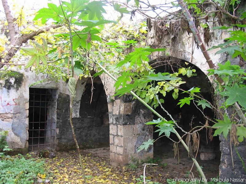
The village today
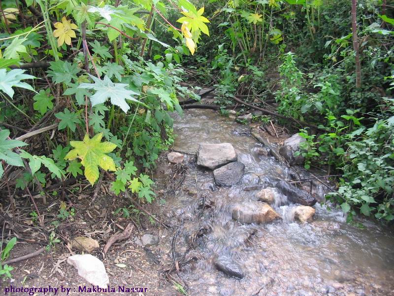
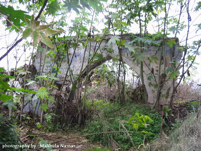
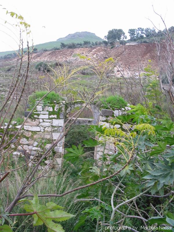
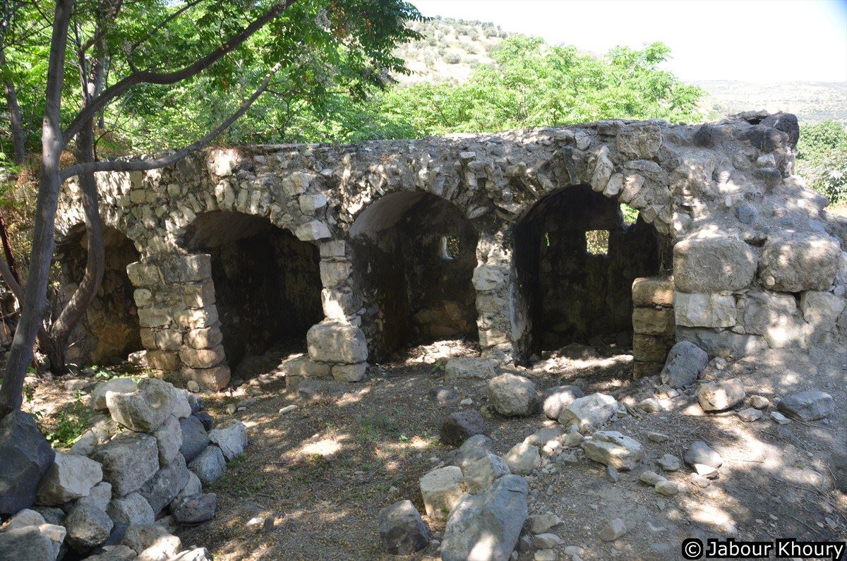
Today, the site is covered with grass with heaps of stone scattered across the village site. There are shallow streams that run past it, in which aquatic plants grow. The mosque is deserted with its minaret intact, but with crumbling arches. Cacti, mulberry-, fig-, and eucalyptus trees grow on the site with the surrounding lands of the plain cultivated. The mountainous lands are used for grazing. Druze pilgrims still use the shrine of al-Nabi Shu’ayb as a holy place.
---------------------------
Source: al-Khalidi, Walid (ed.). All that remains: the Palestinian villages occupied and depopulated by Israel in 1948. Washington DC: 1992.
Images

Videos
Booklets
Others
Publications
Locality tours
